Coffenbury Lake at Fort Stevens

Skip ahead to check conditions

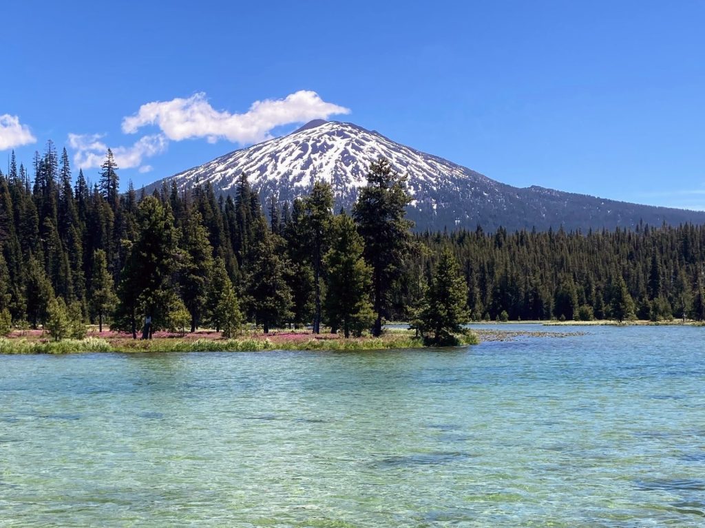
Coffenbury Lake is a natural dune lake located within Fort Stevens State Park in Warrenton where you can spend a day or a week here. Just within the state park, you can paddle at the lake, hike or ride your bike to a beach with a shipwreck, visit a historic military fort and battery, and play on a 23-hole disc golf course with beautiful views of the Columbia River. It’s a unique combination for sure, but it checks all the boxes.

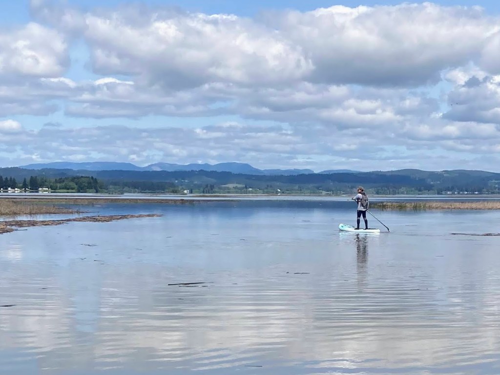
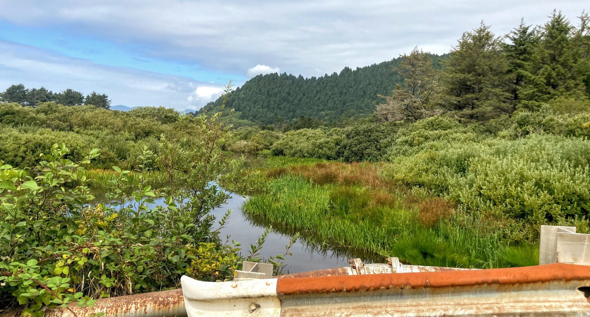
Beginners and first-timers should feel comfortable paddling on this narrow lake where the shoreline is never far away and there is a 10mph speed limit. You will see mostly other kayaks, SUPs, and canoes at this lake. Also, this shallow lake does warm up in the summer for swimming.

Coffenbury Lake has a North and South Day use area. Both have ample paved parking, boat ramp and dock and shoreline access to water. The South day use lot, however, has more picnic tables near the shore.

  • Length: ~2 miles
  • Paddle Time: <1 h*
  • Parking fee: day use fee at kiosk or Oregon State Parks pass or camping reservation
  • Launch: boat ramp, dock, shallow entry
  • Restroom: flush
  • Cell signal: fair

*Time is roughly based on leisurely paddling pace of 2.5mph. Wind, current, equipment, and paddler’s fitness and motivation can change this estimate.

Good to know:

  • Mosquitoes can be a nuisance here, with peak activity around June-July.
  • Open year-round

Directions:

Once you enter Fort Stevens State Park on Peter Iredale Road, pass the campgrounds, then turn left for Coffenbury Lake Day Use Area. Continue straight ahead for North Day Use Area or turn left to drive further down to South Day Use Area.

Additional things to do:

  • Seaside is just a 20-minute drive south and you can walk along the promenade, watch the bubble guy do his thing, visit the aquarium, paddle on the river trails, and eat at some good restaurants.
  • Reserve a site at Fort Stevens State Park campground for your next camping trip. As one of the nation’s largest campgrounds, there is enough to see and do for days. There are sites for RVs, tents, yurts, and even deluxe cabins.

Check before you go:

  • Maps and Suggested Routes: Download or print out a map before you go from the SWT Planner App. As a premium member, you can access an ever-growing library of paddling-related maps and suggested routes.
  • Mosquitoes– this site gives the schedule for mosquito control at Fort Stevens State Park.
  • Toxic algae blooms: This temporary condition occurs at some of the area lakes in the summer and may affect your health if water or fish is consumed during these conditions. Get more info on how to tell if algae is harmful and watch for water advisories but also use common sense if you see water that doesn’t look right.
  • Inspect your watercraft. You can help prevent the spread of aquatic invasive species by wiping off any vegetation or debris from your watercraft and making sure it is dry each time before entering a new waterway.
  • PFD, Whistle, and Waterway Access Permit: In Oregon, all paddlecraft 10′ or longer (including SUPs, kayaks, and canoes) require a permit. You can purchase the permit online.

Beware that the routes and information on this site are just general guides and the best path may vary based on water level, obstructions, experience level, equipment, and other conditions. Paddlers are responsible for providing their own safety. Super Water Trails does not assume any liability.

Hosmer Lake

Skip ahead to check conditions

Hosmer Lake at 4997 ft elevation is one of the natural alpine lakes located along the Cascade Lakes National Scenic Byway, just 36 miles west of Bend. The small gravel parking lot serving this incredibly popular paddling and fly-fishing only lake fills up early and there is often a bottleneck at the launch site. Once you get onto the water though, there is more space to spread out, the views are spectacular, and everyone has a good time.

At Hosmer Lake, you can take in the views of Mt. Bachelor, South Sister, and Broken Top above and follow the fish (Atlantic salmon, brook trout, and rainbow trout) swimming in the clear water below you. The journey is just as rewarding as the views as you paddle from one part of the lake, then through a winding channel that opens into a hidden second part of the lake and finally into the shallow creek that flows into the lake.

This is a beginner-friendly paddle as long as it is not too windy. The average depth of this lake is only 3 ft (maximum of 12 ft) but be aware that the lake floor is muddy and peaty.

Good to know:

  • Electric motors are allowed on this lake, restricted to 10 mph.
  • Best times to visit are June to October
  • Mosquitoes can be a problem, esp. July-early August
  • Get there early as parking can fill up
  • Watch out for strong winds, especially in the afternoons
  • The cellular signal is fair.
In order of appearance: Mt. Bachelor, Broken Top, and South Sister

Directions:

From Bend, take Century Drive (FS Road 46) which becomes the Cascade Lakes Scenic Byway. After passing Mt. Bachelor, go to about MP 35 and turn left at sign for Hosmer(4625).

South Campground has a day use area gravel parking lot and boat ramp. There is a US Forest day use fee for this location, but no vending kiosk on site.

Additional things to do:

Check before you go:

  • Weather: Check the weather forecast for the area and check the wind conditions.
  • Maps and Suggested Routes: Download or print out a map before you go from the SWT Planner App. As a premium member, you can access an ever-growing library of paddling-related maps and suggested routes.
  • Maps and Suggested Routes: Download or print out a map before you go from the SWT Planner App. As a premium member, you can access an ever-growing library of paddling-related maps and suggested routes.
  • Inspect your watercraft. You can help prevent the spread of aquatic invasive species by wiping off any vegetation or debris from your watercraft and making sure it is dry each time before entering a new waterway.
  • PFD, Whistle, and Waterway Access Permit: In Oregon, all paddlecraft 10′ or longer (including SUPs, kayaks, and canoes) require a permit. You can purchase the permit online.

Beware that the routes and information on this site are just general guides and the best path may vary based on water level, obstructions, experience level, equipment, and other conditions. Paddlers are responsible for providing their own safety. Super Water Trails does not assume any liability.

Fern Ridge Reservoir

Skip ahead to check conditions

Fern Ridge Lake is a massive 9,360-acre reservoir in the Long Tom River watershed near Eugene. The lake is known for its windy conditions and is used by the yacht club, the UO Sailing team, as well as windsurfers, boaters, and water-skiers.

Paddlers launching from Orchard Point Park or Shore Lane Park may enjoy exploring Gibson Island and the Amazon wetlands. Or start at the Perkins Peninsula Park at the south end of Fern Ridge Lake and explore the no-wake zone near the Coyote Creek inlet. A pod of pelicans and a great blue heron may be easily spotted during your visit, and there are many more bird species to be spotted as well.

Richardson Park, Orchard Point Park, and Perkins Pensinula Park all provide ample space and amenities for large groups.

Good to Know:

  • The cellular signal reception is generally good or excellent here.
  • Due to the flat shape of the basin, a significant reduction of shoreline occurs with just the 20 ft drawdown that occurs each year. All of the launch sites are seasonal as the area becomes mudflats when the water level is lowered.
  • If the main part of the lake appears too windy, consider paddling at the Coyote Creek channel instead.
  • The water is usually muddy, attributed in part to the high clay content in the soil.

Launch Sites:

Additional things to do:


Check before you go:

  • Maps and Suggested Routes: Download or print out a map before you go from the SWT Planner App. As a premium member, you can access an ever-growing library of paddling-related maps and suggested routes.
  • Weather: Check the weather forecast and pay attention to the wind.
  • Park Status: call Lane County Parks at 541-682-2000 or visit the website.
  • Toxic algae blooms: This temporary condition occurs at some of the area lakes in the summer and may affect your health if water or fish is consumed during these conditions. Get more info on how to tell if algae is harmful and watch for water advisories but also use common sense if you see water that doesn’t look right.
  • Water Temperature: Read the cold water safety page if you need more background info.
 USGS Water-data graph for site 14169000
  • Water level: The reservoir is allowed to fill starting 2/1. Over the summer, the water levels can drop several feet once the rains end. The reservoir is actively drained starting midSeptember. The Perkins Peninsula Park ramp lies at 368ft., Orchard Point 364 ft., Richardson Park 365 ft.
 USGS Water-data graph for site 14168000
  • Inspect your watercraft. You can help prevent the spread of aquatic invasive species by wiping off any vegetation or debris from your watercraft and making sure it is dry each time before entering a new waterway.
  • PFD, Whistle, and Waterway Access Permit: In Oregon, all paddlecraft 10′ or longer (including SUPs, kayaks, and canoes) require a permit. You can purchase the permit online.

Beware that the routes and information on this site are just general guides and the best path may vary based on water level, obstructions, experience level, equipment, and other conditions. Paddlers are responsible for providing their own safety. Super Water Trails does not assume any liability.

Turner Lake

Skip ahead to check conditions

Turner Lake, new to the water scene in 2020, is already quite popular for those who live near this southeast Salem area town of Turner. This is a converted quarry lake of about 70 acres that is now open to the public with a boat ramp and dock and facilities and more exciting development in the works. A creek from the east side empties into it as well as stormwater from the private HOA development on the north end.

Only non-motorized boats or electric motors are allowed and the entire lake is limited to 5mph, making this a kid-friendly and beginner-friendly place to try out paddling. Also, kayak and SUP rentals are available for rent on-site during the summer.

Good to know:

  • The city of Turner manages this lake. Check here for latest parking fees and opening hours and other info.
  • Residents receive a parking pass. Nonresidents pay parking fees Memorial Day weekend to Labor Day weekend.
  • There is a boat ramp and dock.

Directions:


Check before you go:

[ventus width=”100%” height=”300px” radius=”10px” lat=”44.821″ lon=”-122.964″ zoom=”10″ layer=”wind” scale=”F” units=”mph” marker=”true” forecast=”false” time=”now].

  • Inspect your watercraft. You can help prevent the spread of aquatic invasive species by wiping off any vegetation or debris from your watercraft and making sure it is dry each time before entering a new waterway.
  • PFD, Whistle, and Waterway Access Permit: In Oregon, all paddlecraft 10′ or longer (including SUPs, kayaks, and canoes) require a permit. You can purchase the permit online.

Beware that the routes and information on this site are just general guides and the best path may vary based on water level, obstructions, experience level, equipment, and other conditions. Paddlers are responsible for providing their own safety. Super Water Trails does not assume any liability.

Cottage Grove Reservoir

Skip ahead to check conditions

Cottage Grove Reservoir, set in the rolling hills at the south end of Willamette Valley, is a close drive from Eugene and only 1 hour from Roseburg. As with the other Willamette Valley dam projects operated by the US Army Corps of Engineers, it is a popular place for boating and other water sports in the summertime. The water temperature warms up early in the season and reaches a comfortable upper 70s by summertime.

When it comes to launching your paddlecraft, Cottage Grove Reservoir provides several options. Lakeside Park features a low-water boat ramp and spacious beach day use area but tends to be the busiest. On the opposite side of the reservoir, you’ll discover Shortridge Park, a smaller day-use area that grants shoreline access. It’s particularly popular among families who enjoy leisurely floating in the protected cove. Lastly, Wilson Creek Park awaits at the far southern end of the lake. While it may receive fewer visitors due to its location, it boasts a cozy day-use area with a swim beach and sits adjacent to the tranquil no-wake inlet area.

Paddling from Wilson Creek Park to the inlet where the Coast Fork Willamette River flows is typically a peaceful hour-long roundtrip, turning soon after passing under a road bridge. When the winds pick up though, especially in the afternoons, it can make the return more challenging. A paddle around the entire teardrop-shaped reservoir would take approximately 2 hours (5+ miles).

*Time is roughly based on a leisurely paddle pace in typical conditions and includes breaks for longer distances. Wind, current, equipment, and the paddler’s fitness and motivation can greatly affect this estimate.

Good to Know:

  • Cellular signal is generally poor or fair here.
  • It can get choppy here when the winds pick up or with boating activity.
  • The water temperature warms up earlier here and can reach a comfortable upper 70s F in the summer.
  • Waterway restrictions: the inlet south of Wilson Creek Park is a slow no-wake zone.

Launch Sites:

Additional Things To Do:


Check before you go:

  • Maps and Suggested Routes: Download or print out a map before you go from the SWT Planner App. As a premium member, you can access an ever-growing library of paddling-related maps and suggested routes.
  • Weather: Check the weather forecast and pay attention to the wind.
  • Toxic algae blooms: This temporary condition occurs at some of the area lakes in the summer and may affect your health if water or fish is consumed during these conditions. Get more info on how to tell if algae is harmful and watch for water advisories but also use common sense if you see water that doesn’t look right.
  • Water Temperature: The water temperature warms up in May and reaches a comfortable upper 70s in the summer. Read the cold water safety page if you need more background info.
 USGS Water-data graph for site 14152500
Coast Fork Willamette River at London, OR stream monitor at inlet
  • Water Level:
 USGS Water-data graph for site 14153000
Lakeside boat ramp 745 ft. , Wilson Creek Park boat ramp 779 ft.
  • Inspect your watercraft. You can help prevent the spread of aquatic invasive species by wiping off any vegetation or debris from your watercraft and making sure it is dry each time before entering a new waterway.
  • PFD, Whistle, and Waterway Access Permit: In Oregon, all paddlecraft 10′ or longer (including SUPs, kayaks, and canoes) require a permit. You can purchase the permit online.

Beware that the routes and information on this site are just general guides and the best path may vary based on water level, obstructions, experience level, equipment, and other conditions. Paddlers are responsible for providing their own safety. Super Water Trails does not assume any liability.

Lake Lytle

Skip ahead to check conditions

Lake Lytle is the largest of a string of small lakes along the Hwy 101 in Rockaway Beach that once formed a channel of the Nehalem River. The geologic history is similar to the sand dune lakes in Florence, such as Cleawox Lake or Woahink Lake.

What makes this a fun place to visit is that you can paddle through a little canal to access Crescent Lake, which is a smaller motorboat-free lake. This is a family-friendly paddle due to the small size, a motorboat-free section, and places to pull over if needed. It is sheltered from wind somewhat and the entire lake averages only about 5 ft. deep. Consider paddling at this lake if winds pick up elsewhere or the timing of the tides isn’t right for paddling at the Nehalem.

Good to know:

  • The cellular signal is average to poor here.
  • Although the main lake has no speed restrictions, you can paddle through a small channel into a smaller lake.

Driving Directions:

Parking:

The parking lot for the county boat ramp is on 12 th st.

Lake Lytle parking area
Parking lot Tillamook County boat ramp and vault toilet.

An alternate parking spot might be on the side of Highway 101 near the fishing dock.

More things to do:

  • Here are some ideas of things to do while you are visiting Rockaway Beach.

Check before you go:

  • Maps and Suggested Routes: Download or print out a map before you go from the SWT Planner App. As a premium member, you can access an ever-growing library of paddling-related maps and suggested routes.
  • Parking fee: the day use fee is $10 or purchase the Tillamook County Annual pass. This pass can also be used at other Tillamook County boat launches.
  • Weather: Check the weather forecast and pay attention to the wind.
  • Inspect your watercraft. You can help prevent the spread of aquatic invasive species by wiping off any vegetation or debris from your watercraft and making sure it is dry each time before entering a new waterway.
  • PFD, Whistle, and Waterway Access Permit: In Oregon, all paddlecraft 10′ or longer (including SUPs, kayaks, and canoes) require a permit. You can purchase the permit online.

Beware that the routes and information on this site are just general guides and the best path may vary based on water level, obstructions, experience level, equipment, and other conditions. Paddlers are responsible for providing their own safety. Super Water Trails does not assume any liability.