North Fork Reservoir

Skip ahead to check conditions

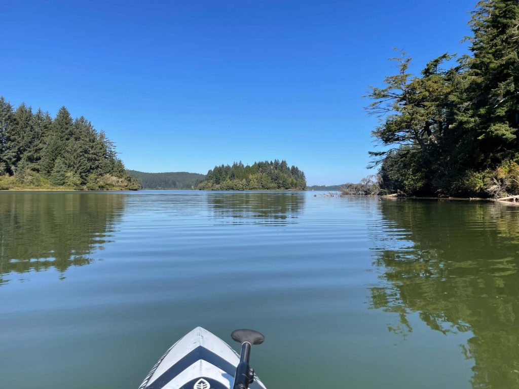
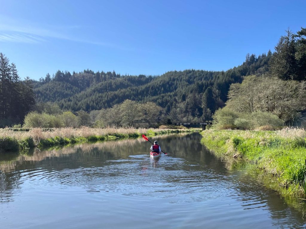
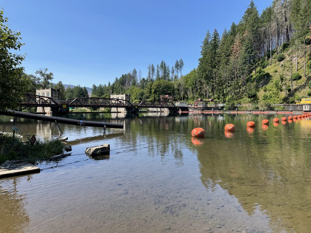
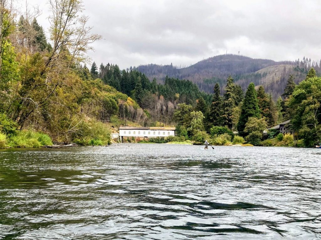
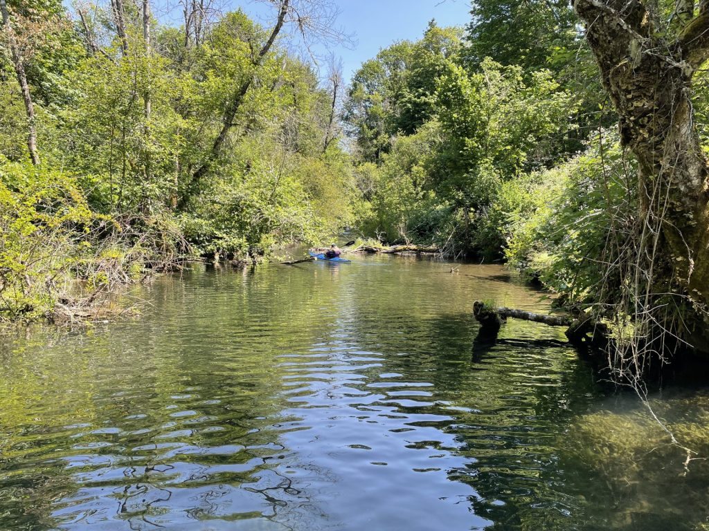
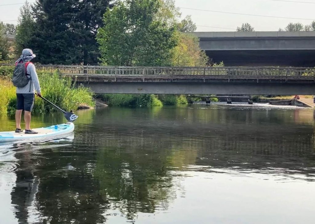
North Fork Reservoir in Estacada is lined by narrow steep canyons in the foothills of the Cascade mountains. It is one of several reservoirs along the Clackamas River, such as Estacada Lake, which were built to provide hydroelectric power. The water runs clear and cold here. At less than an hours’ drive from Portland, it is a popular place for paddling, as well as boating, waterskiing, and fishing. Paddlers who want to avoid boat wake can go up the inlet that is south of Promontory Park or paddle around by the culvert.

Good to know:

Put-In Locations:

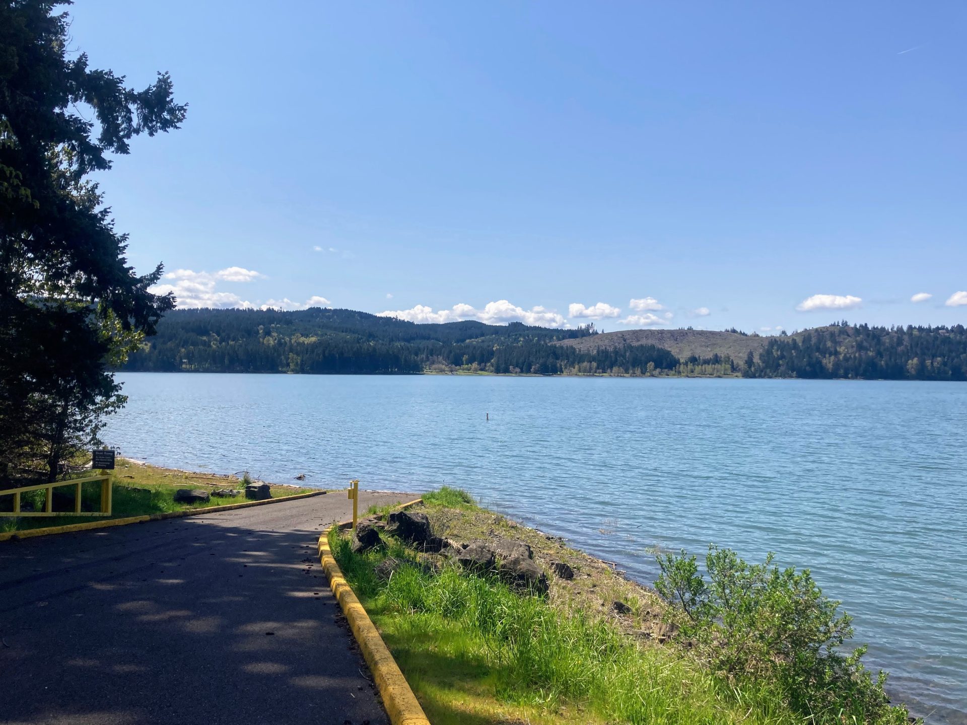
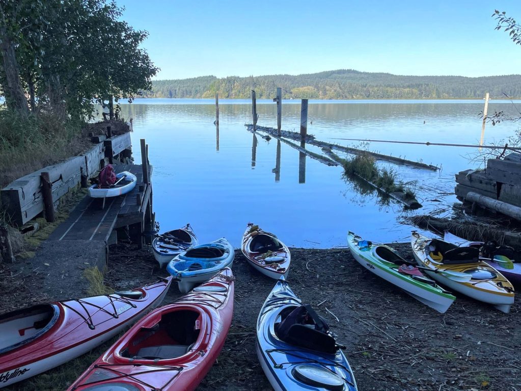
Promontory Park Marina

  • Parking fee: none
  • Launch Type: kayak dock, boat ramp
  • Restrooms: flush

There is a large paved parking lot with a lot of parking spaces for trailers. A convenience store with boat rentals is also located here.

Directions:

From Estacada OR-224E, after passing E. Faraday Road, turn right at the Promontory Park sign. Then follow the road to the right for the marina.
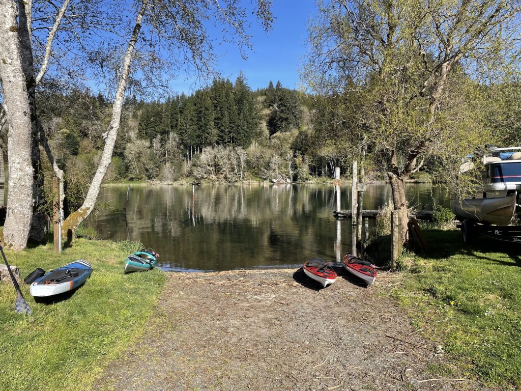
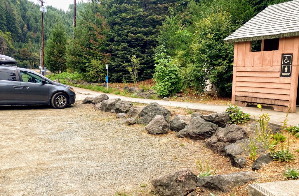
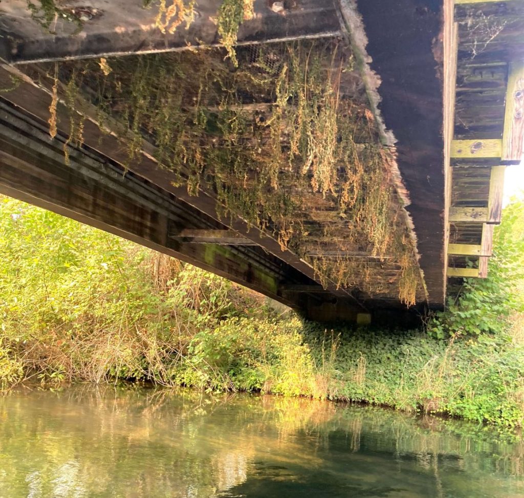
The Culvert

  • Parking fee: none
  • Launch Type: shore
  • Restrooms: none

The parking lot has space for about 25 cars and faces the shoreline. This area is in a slow-no wake zone.

Directions:

From Estacada OR-224E, soon after passing East Faraday Road (North Shore ramp), look for the turnout on the left. Turn left and proceed to small paved parking lot by the culvert.
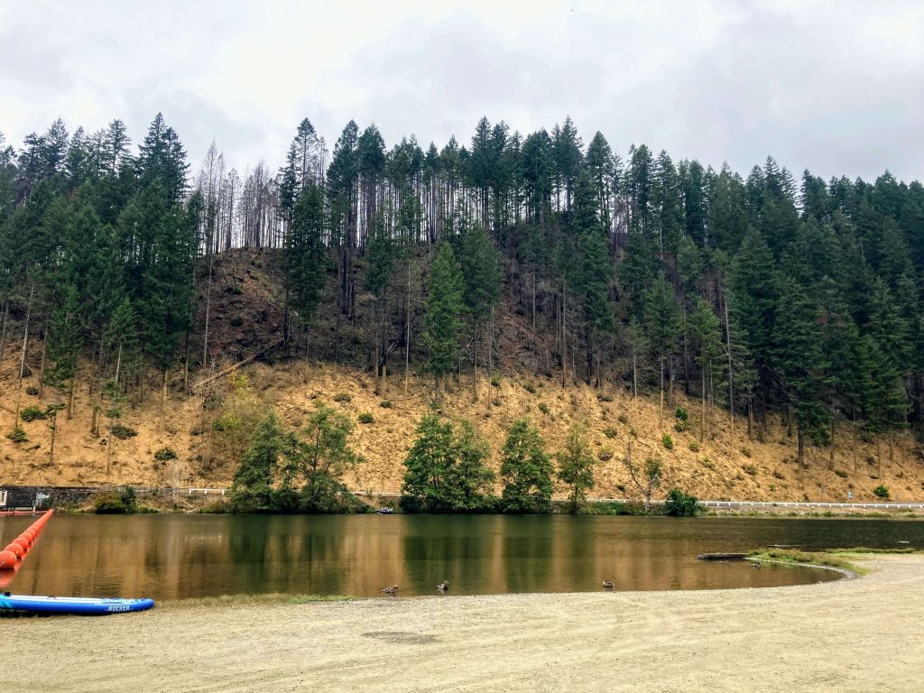
North Shore Ramp

  • Parking fee: none
  • Launch Type: boat ramp
  • Restrooms: flush

This parking lot is large and has room for trailers. It is the closest boat ramp coming from Estacada, but it is located on the busy main portion of the lake where there is no speed restriction.

Directions:

From Estacada OR-224E, turn right on E. Faraday Road. Proceed to parking lot on the left.

Additional things to do:


Check before you go:

  • Maps and Suggested Routes: Download or print out a map before you go from the SWT Planner App. As a premium member, you can access an ever-growing library of paddling-related maps and suggested routes.
  • Water Temperature: Read the cold water safety page if you need more background info.
 USGS Water-data graph for site 14210000
  • Inspect your watercraft. You can help prevent the spread of aquatic invasive species by wiping off any vegetation or debris from your watercraft and making sure it is dry each time before entering a new waterway.
  • PFD, Whistle, and Waterway Access Permit: In Oregon, all paddlecraft 10′ or longer (including SUPs, kayaks, and canoes) require a permit. You can purchase the permit online.

Beware that the routes and information on this site are just general guides and the best path may vary based on water level, obstructions, experience level, equipment, and other conditions. Paddlers are responsible for providing their own safety. Super Water Trails does not assume any liability.

Dorena Reservoir

Skip ahead to check conditions

Dorena Reservoir is an impoundment of the Row River in Cottage Grove, Oregon. Even though it is less than 30 miles south of Eugene, this area feels like a hidden gem with miles of easily accessible hiking and biking trails, waterfalls, and of course, paddling.

At full pool, a paddle around the entire lake would take about 3 1/2 hours (8.4 miles)*. The inlet which is located in the no-wake zone can be paddled for a little distance. This would be to the right of Baker Bay or to the left from Harms Park.

*Time is roughly based on a leisurely paddle pace in typical conditions and includes breaks for longer distances. Wind, current, equipment, and the paddler’s fitness and motivation can greatly affect this estimate.

Good to Know:

  • Cellular signal appears good at Harms Park but poor elsewhere.
  • Watch for boat wake and chop in the open main portion of the lake.
  • Water temperature warms up in the summer to 70s.

Put-In Locations

Harms Park

  • Parking fee: none
  • Launch type: boat ramp
  • Restrooms: vault
  • Open: year-round

There are some picnic tables overlooking the lake but no swimming area.

Although this park is open year-round, the boat ramp closes when the water is low. Launching from this boat ramp is best when the reservoir is at or near full pool in the early to mid-summer months.

You can also access the Row River Trail from this park.

Harms Park Boat Ramp

Baker Bay Marina

  • Parking fee: Lane County pass or day use fee
  • Launch type: boat ramp, dock, shore
  • Restrooms: flush
  • Open: mid April to mid October

There is a swim beach, seasonal rentals, and a campground here.

Additional Things to Do:

  • Camp by the lakefront at Baker Bay campground
  • Bike or hike the popular Row River Trail, a 14-mile long rails-to-trails conversion and site of multiple scenes from the 1986 movie Stand By Me.
  • Drive down to Culp Creek (about 15 min. drive) to see Wildwood Falls.

Check before you go:

  • Maps and Suggested Routes: Download or print out a map before you go from the SWT Planner App. As a premium member, you can access an ever-growing library of paddling-related maps and suggested routes.
  • Weather: Check the weather forecast for the area and check the wind conditions.
  • Toxic algae blooms: This temporary condition occurs at some of the area lakes in the summer and may affect your health if water or fish is consumed during these conditions. Get more info on how to tell if algae is harmful and watch for water advisories but also use common sense if you see water that doesn’t look right.
 USGS Water-data graph for site 14154500
Row River above Pitcher Creek near Dorena, OR stream monitor
  • Water level– Watch for exposed mudflats when the water level starts dropping below the boat ramp level.
 USGS Water-data graph for site 14155000
Harms Park boat ramp 820 ft., Baker Bay boat ramp 765 ft.
  • Inspect your watercraft. You can help prevent the spread of aquatic invasive species by wiping off any vegetation or debris from your watercraft and making sure it is dry each time before entering a new waterway.
  • PFD, Whistle, and Waterway Access Permit: In Oregon, all paddlecraft 10′ or longer (including SUPs, kayaks, and canoes) require a permit. You can purchase the permit online.

Beware that the routes and information on this site are just general guides and the best path may vary based on water level, obstructions, experience level, equipment, and other conditions. Paddlers are responsible for providing their own safety. Super Water Trails does not assume any liability.

Tahkenitch Lake

Skip ahead to check conditions

Tahkenitch Lake, located between Florence and Reedsport, is one of the larger coastal dune lakes. The many arms of the lake provide about 27 miles of shoreline with coves, marshes, and wetlands, making it a paradise for paddlers and fishermen alike.

Tahkenitch Lake is a beginner-friendly lake under good weather conditions. The main limitation for paddlers would be the strong winds that can start as early as noon.

Good to Know:

  • Cellular reception is fair here.
  • This location is good for year-round paddling.
  • A good map (printed or offline) is recommended here due to the similar shoreline patterns.

Put-In Locations:

Tahkenitch Lake Boat Ramp

  • Parking fee: USFS day use fee
  • Launch type: boat ramp, dock
  • Restrooms: vault
  • Open: year-round

Driving Directions:

The Tahkenitch Lake Boat Ramp is north of the Tahkenitch Landing Boat Ramp.

Tahkenitch Landing

  • Parking fee: USFS day use fee
  • Launch type: boat ramp
  • Restrooms: vault
  • Open: year-round, 6am- 10pm

Driving Directions:

The Tahkenitch Landing Boat Ramp is 1/4 mile south of the Tahkenitch Lake Boat Ramp and is located at the Tahkenitch Landing Campground. (Don’t confuse this with the Tahkenitch Campground located on the west side of Hwy 101.)


Check before you go:

  • Maps and Suggested Routes: Download or print out a map before you go from the SWT Planner App. As a premium member, you can access an ever-growing library of paddling-related maps and suggested routes.
  • Water Temperature: Read the cold water safety page if you need more background info.
  • Inspect your watercraft. You can help prevent the spread of aquatic invasive species by wiping off any vegetation or debris from your watercraft and making sure it is dry each time before entering a new waterway.
  • PFD, Whistle, and Waterway Access Permit: In Oregon, all paddlecraft 10′ or longer (including SUPs, kayaks, and canoes) require a permit. You can purchase the permit online.

Beware that the routes and information on this site are just general guides and the best path may vary based on water level, obstructions, experience level, equipment, and other conditions. Paddlers are responsible for providing their own safety. Super Water Trails does not assume any liability.

Siltcoos Lake

Skip ahead to check conditions

Siltcoos Lake, located between Florence and Reedsport, wins the prize for being the largest Oregon coast lake at 3,164 acres. Its 28 miles of shoreline presents a mix of private marinas and resorts, county parks, private lakefront homes, as well as undeveloped forest. Siltcoos Lake is shallow with an average depth of 11 ft and it is well-known for fishing warm-water species.

Many paddlers gravitate to the Siltcoos River paddle trail and avoid the choppy conditions that this massive lake is prone to. But on calmer and quieter days, such as early mornings or in the winter or spring, there are plenty of other paddling options to consider. Premium members may access the library of suggested paddle routes and maps.

  • Cellular reception is fair here.
  • Watch for choppy conditions, avoid large crossings.
  • No boating restrictions here. Watch for speeding boats and watercraft.
  • A good map (printed or offline) is recommended due to the size of the lake.

Launch Sites:

Westlake boat ramp

  • Parking fee: day use fee $5 or Lane County Parks pass
  • Launch type: boat ramp, dock, grassy shoreline
  • Restrooms: vault
  • Open: year-round

Driving Directions: From Florence, OR drive south on Hwy 101 for 7 miles. Turn left onto Pacific Avenue. Proceed straight for 0.4 miles and you will see Westlake County Park straight ahead of you.

From Reedsport, OR drive north on Hwy 101 for 15 miles. Turn right onto Pacific Avenue. Proceed straight for 0.4 miles and you will see Westlake County Park straight ahead of you.

Darling’s RV Resort & Marina

  • Launch fee: $5
  • Launch type: boat ramp, dock
  • Restrooms: vault
  • Open: year-round
  • Amenities: On-site kayak rentals, RV camping, restaurant

Nightingale’s Fishing Camp

  • Launch fee: $5
  • Launch type: boat ramp, dock
  • Restrooms: flush
  • Open: year-round
  • Amenities: Tent and RV camping
  • Contact: (541) 997-2892

ADA Fishing Resort

  • Launch fee: $7
  • Launch type: boat ramp, dock
  • Restrooms: flush
  • Open: year-round
  • Amenities: RV and tent camping, general store
  • Contact: (541) 997-2342

Driving Directions: From Florence Highway 101 go south about 2 miles. Turn left onto Canary Road. At the T, turn right onto S Canary Road. Then turn right on Ada/ S Canary Road. The road narrows to a one-lane paved road along the water’s edge for the last few miles. An alternate route is after the T, turn right on Siltcoos Station Road, and follow the road to ADA Resort. The last few miles are gravel road.

ADA Park

  • Launch fee: $5 day use fee or Lane County Parks pass
  • Launch type: boat ramp
  • Restrooms: portable
  • Open: year-round

According to the Lane County Parks website, there are 14 parking spaces here. There is also an area for picnicking.


Check before you go:

  • Maps and Suggested Routes: Download or print out a map before you go from the SWT Planner App. As a premium member, you can access an ever-growing library of paddling-related maps and suggested routes.
  • Water Temperature: Read the cold water safety page if you need more background info.
  • Inspect your watercraft. You can help prevent the spread of aquatic invasive species by wiping off any vegetation or debris from your watercraft and making sure it is dry each time before entering a new waterway.
  • PFD, Whistle, and Waterway Access Permit: In Oregon, all paddlecraft 10′ or longer (including SUPs, kayaks, and canoes) require a permit. You can purchase the permit online.

Beware that the routes and information on this site are just general guides and the best path may vary based on water level, obstructions, experience level, equipment, and other conditions. Paddlers are responsible for providing their own safety. Super Water Trails does not assume any liability.

Leaburg Dam at McKenzie River

Skip ahead to check conditions

Enjoy this no-wake flatwater portion of the beautiful McKenzie River at Leaburg Dam and the photo-ops of the iconic covered bridge known as Goodpasture Bridge. Leaburg Dam is located only 22 miles east of Springfield and is used by EWEB to provide hydroelectric power to some Eugene homes.

There are two public launch sites along this stretch of the river from Leaburg Dam to Goodpasture Bridge. The boat ramp next to Lloyd Knox Park is the favored starting point for an out-and-back paddle, going against the mild current first and then getting a little boost on the return. The Goodpasture Boat Ramp is located on the other end, very close to the Goodpasture Covered Bridge.

Good to Know:

  • The cellular signal is poor or fair.
  • The water is always cold here, so this is probably not the best choice for first-timers or someone who is prone to falling in. In the warmest months of July and August, for example, you can anticipate water temperatures in the low 60’s.
  • There is a waterway restriction of slow no-wake 5mph for this entire route.

Launch Sites:

Lloyd Knox Park

  • Parking fee: none
  • Launch type: boat ramp, gradual shore
  • Restrooms: vault
  • Open: year round

Driving Directions:

From OR-126, turn at Leaburg Dam Road and cross over the 1-lane bridge. Immediately after crossing the bridge, turn left into the small gravel parking lot next to to the dam.

Goodpasture Boat Ramp

  • Parking fee: none
  • Launch type: boat ramp
  • Restrooms: vault

Additional things to do:

  • Visit the Leaburg fish hatchery, which is located next to the dam.
  • Enjoy a picnic at Lloyd Knox Park that is also maintained by EWEB.

Check before you go:

  • Maps and Suggested Routes: Download or print out a map before you go from the SWT Planner App. As a premium member, you can access an ever-growing library of paddling-related maps and suggested routes.
  • Weather: Check the weather forecast and pay attention to the wind.
  • Water Temperature: Read the cold water safety page if you need more background info.
 USGS Water-data graph for site 14163150
  • Check the flow: This is usually an easy out-and-back paddle during the months of April to October when the flow is less than 5000 cfs. (It has been noted, however, that this paddle can get difficult going upstream when it is> 12,000 cfs.)
 USGS Water-data graph for site 14163150
  • Inspect your watercraft. You can help prevent the spread of aquatic invasive species by wiping off any vegetation or debris from your watercraft and making sure it is dry each time before entering a new waterway.
  • PFD, Whistle, and Waterway Access Permit: In Oregon, all paddlecraft 10′ or longer (including SUPs, kayaks, and canoes) require a permit. You can purchase the permit online.

Beware that the routes and information on this site are just general guides and the best path may vary based on water level, obstructions, experience level, equipment, and other conditions. Paddlers are responsible for providing their own safety. Super Water Trails does not assume any liability.

Alton Baker Canoe Canal

Skip ahead to check conditions

The Alton Baker canoe canal is a side channel of the Willamette River in Eugene, OR which allows for a fun out-and-back paddle without the rapids. Situated just across from the Autzen stadium where the Oregon Ducks play, this place is a popular in-town option for those seeking a quick paddle and connection with nature. And it is a suitable paddling spot for first-timers and families with children.

Good to Know:

  • It can get busy in the summertime with -SUP’ers, kayakers, and anglers- but it is just large enough to find your space here (and parking).
  • Although it is open year-round, the best times to paddle here are usually May-October.
  • Cellular reception is good.

Canoe Launch

  • Parking fee: none
  • Launch type: primitive bank
  • Restrooms: none
  • Open: year-round

This parking lot can hold ~35-40 cars. Locate the canoe launch sign and a short gravel and dirt path leading to the canoe canal access.

Driving Directions:

Navigate to Leo Harris Parkway and locate the small gravel lot located directly across the street from the Autzen Stadium “O.”

Alton Baker Park Duck Ponds

  • Parking fee: none
  • Restrooms: flush toilets on west side of Day Island Road (across the street)
  • Open: year-round
duck pond at Alton Baker park
alternate launch from duck ponds at Alton Baker park

Driving Directions:

Park near the disc golf course at Alton Baker Park off Day Island Road and start at the duck ponds. This is a larger parking lot and it is near restrooms but there is about a 100-yard walk from the parking lot to the pond and the paddle from here involves 2 portages.

Additional things to do:

There are plenty of other things to do at Alton Baker park if you want to make an entire day of it. One really cool and unique feature is the solar system placed to scale along a multi-use path. You would start at the large model of a Sun at the park and then continue along the Ruth Bascom Riverbank Path System (South Bank path) until you get to Pluto about 3.5 miles away.


Check before you go:

  • Maps and Suggested Routes: Download or print out a map before you go from the SWT Planner App. As a premium member, you can access an ever-growing library of paddling-related maps and suggested routes.
  • Weather: Check the weather forecast and pay attention to the wind.
  • Water Temperature: Read the cold water safety page if you need more background info.
 USGS Water-data graph for site 14158100
  • Water flow: The nearby Willamette River generally flows at below 4000 cfs during the summer months which allows for an easy paddle at the canal. At much higher flows, such as when it is >12,000 cfs, the current can be quite swift.
  • Questions: contact Willamalane Park District at 503-434-7463
  • Game Days: Note that the canoe launch parking lot is located right across the street from Autzen stadium, which makes it inaccessible during Oregon Ducks games and Emeralds events. You may consider the alternate launch from the Alton Baker Park duck pond when this parking is inaccessible. Check the Ducks game schedule and the Emeralds schedule (season is April to Sept).
  • Concerts at Cuthbert: Parking can also be difficult when there are events at Cuthbert Amphitheater. Here is the schedule of events.
  • PFD, Whistle, and Waterway Access Permit: In Oregon, all paddlecraft 10′ or longer (including SUPs, kayaks, and canoes) require a permit. You can purchase the permit online.

Beware that the routes and information on this site are just general guides and the best path may vary based on water level, obstructions, experience level, equipment, and other conditions. Paddlers are responsible for providing their own safety. Super Water Trails does not assume any liability.

Crane Prairie Reservoir

Skip ahead to check conditions

Crane Prairie Reservoir is located just above Wickiup Reservoir along the Cascade Lakes Scenic Byway and less than an hour’s drive from Bend. The name aptly describes its former existence of flat prairie land that attracted a large population of cranes each year when the Deschutes River flooded the area. This shallow reservoir contributes water for irrigation and when it is full has an average depth of only 11 ft.

There are 23 miles of shoreline including several deep feeder creeks to explore. Views of wildlife are abundant here- osprey, bald eagles, pelicans, and herons, to name a few- as are the views of Mt. Bachelor, South Sister, and Broken Top in the background. This is also a very popular location for fishing.

Beginners can paddle here but should be mindful of the prevailing wind conditions and watch out for the plentiful underwater tree snags.

Good to know:

  • The entire lake is restricted to 10 mph.
  • Open after the lake thaws out and road access is cleared, usually May to October.
  • The water level is kept high in order to protect the Oregon spotted frog habitat.
  • Mosquitoes and other insects can be a problem, esp. June-early August
  • Check for toxic algae blooms as this reservoir has been known to get them.
  • The cellular signal is fair.

Directions:

There are four US Forest Service campgrounds with boat access and an additional boating access point as well as a private resort. The links on this map can provide more details.

Check before you go:

  • Weather: Check the weather forecast for the area and check the wind conditions.
  • Maps and Suggested Routes: Download or print out a map before you go from the SWT Planner App. As a premium member, you can access an ever-growing library of paddling-related maps and suggested routes.
  • Inspect your watercraft. You can help prevent the spread of aquatic invasive species by wiping off any vegetation or debris from your watercraft and making sure it is dry each time before entering a new waterway.
  • PFD, Whistle, and Waterway Access Permit: In Oregon, all paddlecraft 10′ or longer (including SUPs, kayaks, and canoes) require a permit. You can purchase the permit online.

Beware that the routes and information on this site are just general guides and the best path may vary based on water level, obstructions, experience level, equipment, and other conditions. Paddlers are responsible for providing their own safety. Super Water Trails does not assume any liability.

Siltcoos River

Skip ahead to check conditions

The Siltcoos River Water Trail takes you from the largest lake on Oregon’s coast, through towering sand dunes and forests and brings you to a special stretch of ocean where snowy plovers nest on protected beaches. Along the way, there are tricky logjams that challenge your skills of Twister and a dam portage with a kayak slide (you know, for grownups). Sound interesting enough?

There is very little elevation change along the length of the Siltcoos River, so the current is usually mild enough that it can be paddled in either direction even for beginners. The wind can be a factor though, especially in the afternoons near the ocean and at Siltcoos Lake.

This is a popular river trail so you will likely encounter other kayakers and paddleboarders on the water (and also river otters).

Good to Know:

  • Beware that if the dam is open, such as during the rainy season October -May, the faster river flows can make the log strainers quite dangerous and should be avoided.
  • Preferably, time your paddle so that you reach the beach at or near high tide to avoid bottoming out for that last mile.
  • Standup paddleboarders, consider using shorter river fins to paddle the lower section from the dam to the ocean.
  • During the protected snowy plover season (March 15- Sep 15), beach access is limited to just the wet sand and dogs are not allowed to get out on the beach at all.
  • Cellular reception is poor here. Consider downloading a map prior to going out.

Highlights from Lake to Ocean:

Additional things to do:

  • Camping- Get an early start on the Siltcoos River. Tyee Campground and Waxmyrtle Campground have access to the Siltcoos River.
  • Fishing and more paddling at Siltcoos Lake
  • Hiking- get nice views of the Siltcoos River and access the beach on the Waxmyrtle trail

Check before you go:

  • Maps and Suggested Routes: Download or print out a map before you go from the SWT Planner App. As a premium member, you can access an ever-growing library of paddling-related maps and suggested routes.
  • Weather– Check the weather forecast for the area and consider the wind conditions.
  • Tides-Tidal reports should be consulted to make sure there is enough water depth to navigate the lower portion. Premium members on the SWT Planner App can get timing recommendations. Also, watch for very high tides that may affect your passage through the logjams.
  • Parking fees– For Westlake, you can purchase the Lane County parks day pass online or at a local vendor, or use the self-pay envelopes at the park. For Lodgepole and Waxmyrtle, purchase a NW Forest day pass online or buy at a local vendor.
  • Inspect your watercraft. You can help prevent the spread of aquatic invasive species by wiping off any vegetation or debris from your watercraft and making sure it is dry each time before entering a new waterway.
  • PFD, Whistle, and Waterway Access Permit: In Oregon, all paddlecraft 10′ or longer (including SUPs, kayaks, and canoes) require a permit. You can purchase the permit online.

Beware that the routes and information on this site are just general guides and the best path may vary based on water level, obstructions, experience level, equipment, and other conditions. Paddlers are responsible for providing their own safety. Super Water Trails does not assume any liability.

Carter Lake

Skip ahead to check conditions

Carter Lake is a small coastal dune lake located just 11 miles south of Florence. There is a 10mph speed restriction for the entire lake which makes this a great beginners or family-friendly lake. You can paddle around 2 miles of shoreline. The major factor to watch for is that it can get very windy here when the wind picks up and it usually blows in from the north in summer. The water appears quite clear and is nice for swimming, too.

There is a day use area with a small sandy beach tucked away in the Carter Lake campground. It has a few parking spots but requires the NW Forest Pass or equivalent. The nearest restrooms and water are located within the campground itself. The boat ramp for Carter Lake is located on the opposite side of the lake and can be reached off of the Highway 101, south of the Carter Lake campground.

Good to know:

  • By late summer in dry years, the water level may get too low to paddle the entire length.
  • The campground and day use area is open 5/1-9/30.
  • The boat ramp off Hwy 101 is open year-round.
  • Carter Lake is managed by the Siuslaw National Forest division.
  • The cellular reception here is poor.

Directions:

The Carter Lake day use area is located within the Carter Lake campground. Drive to the end of the loop to the small day use parking lot.

The Carter Lake boat ramp is located directly off Hwy 101, south of the campground entrance.

Additional things to do:

  • Stay at the Carter Lake campground where you may get a spot that backs up to sand dunes or, if you can manage the steep access, you can get a spot overlooking the water.

Check before you go:

  • Maps and Suggested Routes: Download or print out a map before you go from the SWT Planner App. As a premium member, you can access an ever-growing library of paddling-related maps and suggested routes.
  • Weather: Check the weather forecast and pay attention to the wind. A lot of summer afternoons typically have northern winds which can whip through this lake.
  • Park status: Check on the Carter campground area status.
  • Inspect your watercraft. You can help prevent the spread of aquatic invasive species by wiping off any vegetation or debris from your watercraft and making sure it is dry each time before entering a new waterway.
  • PFD, Whistle, and Waterway Access Permit: In Oregon, all paddlecraft 10′ or longer (including SUPs, kayaks, and canoes) require a permit. You can purchase the permit online.

Beware that the routes and information on this site are just general guides and the best path may vary based on water level, obstructions, experience level, equipment, and other conditions. Paddlers are responsible for providing their own safety. Super Water Trails does not assume any liability.

Lake Marie

Skip ahead to check conditions

Lake Marie is a sweet little coastal lake located near Winchester Bay. With only a 1-mile long shoreline and the absence of motorized boats, Lake Marie is suitable for early beginners and paddling with children. There is also a small beach area near the parking lot, a 1 mile tree-covered hiking trail around the lake, and the nearby lighthouse to keep everyone in the group busy.

The water is clear and warms up enough for swimming in the summertime. This lake might also be an option if the conditions are not optimal for paddling at one of the larger nearby lakes or river.

Good to know:

  • Watch for woody debris and snags, especially near the shore line.
  • The cellular reception is good or very good here.
  • Similar to other small lakes in the area, expect water temperatures in the low 50s during the winter and low to mid 70s in the summer.

Directions:

Navigate to Umpqua Lighthouse State Park from Hwy 101. Continue to parking near Lake Marie Trailhead.

Additional things to do:

  • Stay at the Umpqua Lighthouse SP campground which not only has tent and RV sites, but also cabins and deluxe yurts. There are some trails leading from the campground to the lake.
  • Hike around Lake Marie which is only 1 mile, plenty of shade for sunny hot days, and plenty of views of the lake.
  • Tour the Umpqua River Lighthouse which is managed by the Umpqua Valley Museums.

Check before you go:

  • Maps and Suggested Routes: Download or print out a map before you go from the SWT Planner App. As a premium member, you can access an ever-growing library of paddling-related maps and suggested routes.
  • Inspect your watercraft. You can help prevent the spread of aquatic invasive species by wiping off any vegetation or debris from your watercraft and making sure it is dry each time before entering a new waterway.
  • PFD, Whistle, and Waterway Access Permit: In Oregon, all paddlecraft 10′ or longer (including SUPs, kayaks, and canoes) require a permit. You can purchase the permit online.

Beware that the routes and information on this site are just general guides and the best path may vary based on water level, obstructions, experience level, equipment, and other conditions. Paddlers are responsible for providing their own safety. Super Water Trails does not assume any liability.