Willamette River at Cedaroak

Skip ahead to check conditions

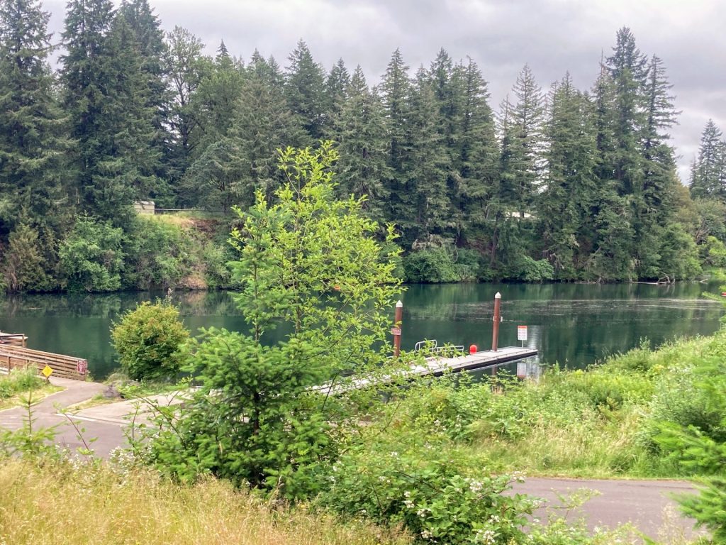
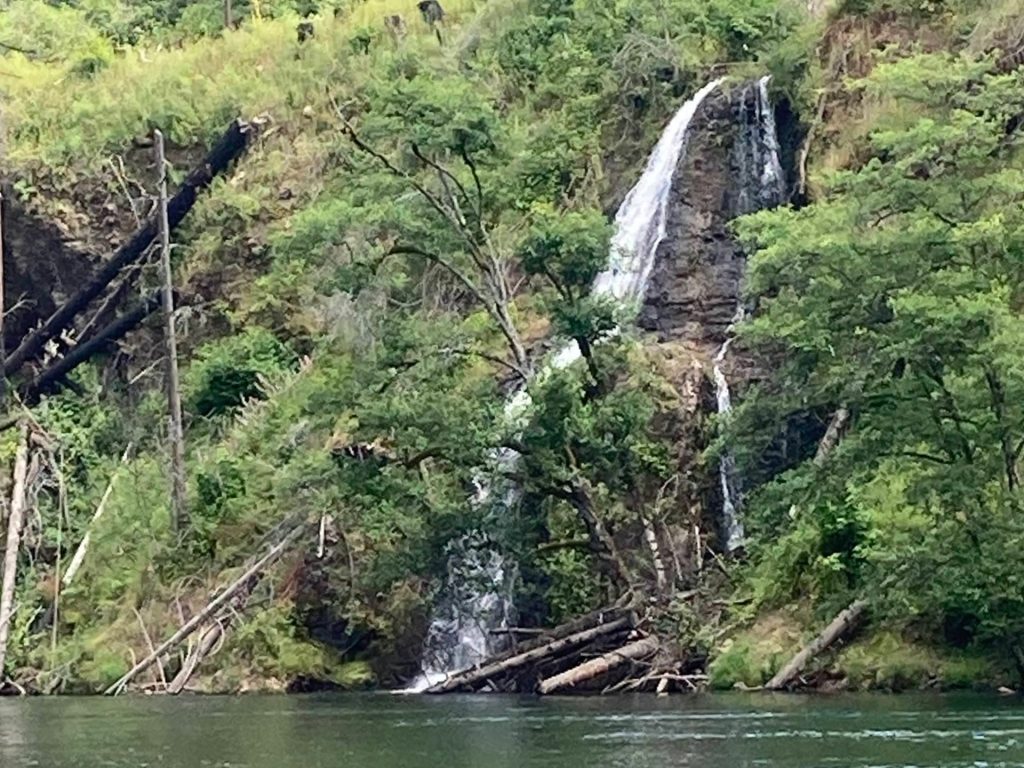
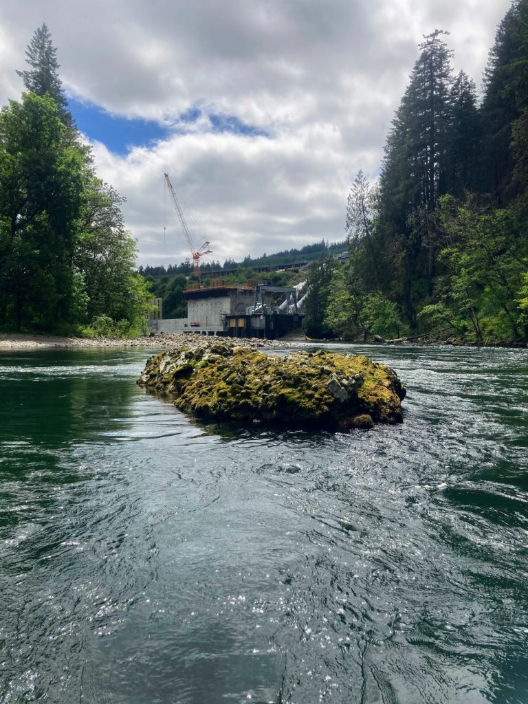
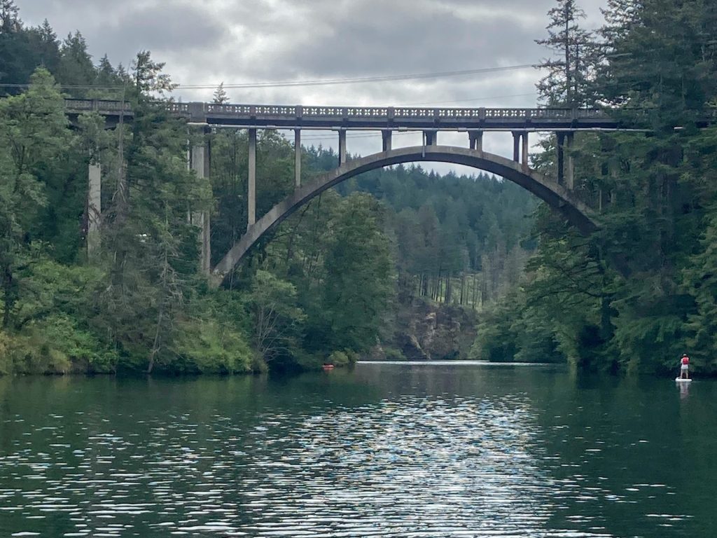
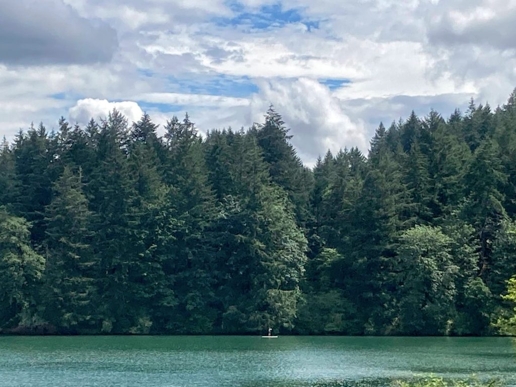
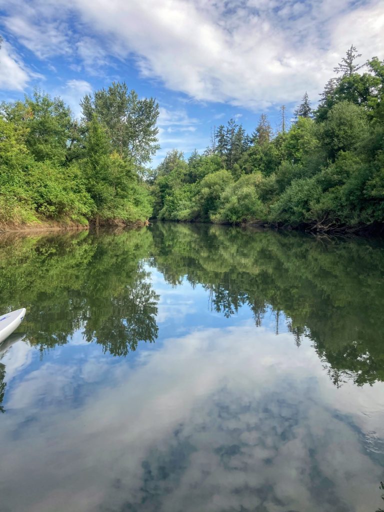
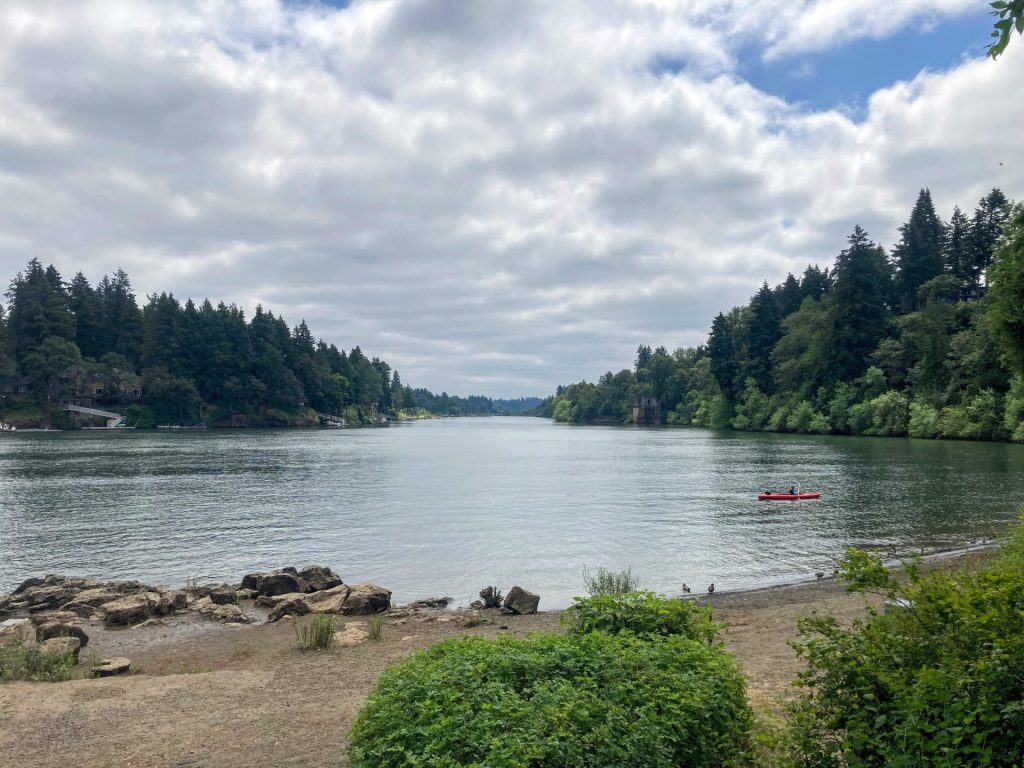
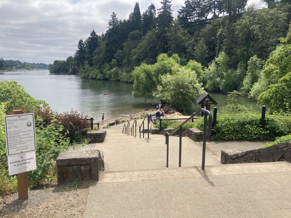
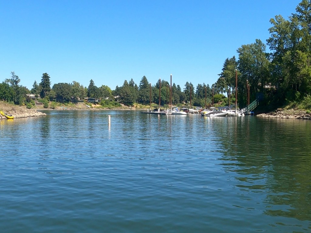
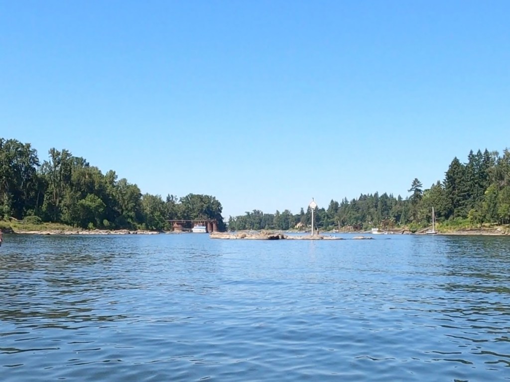
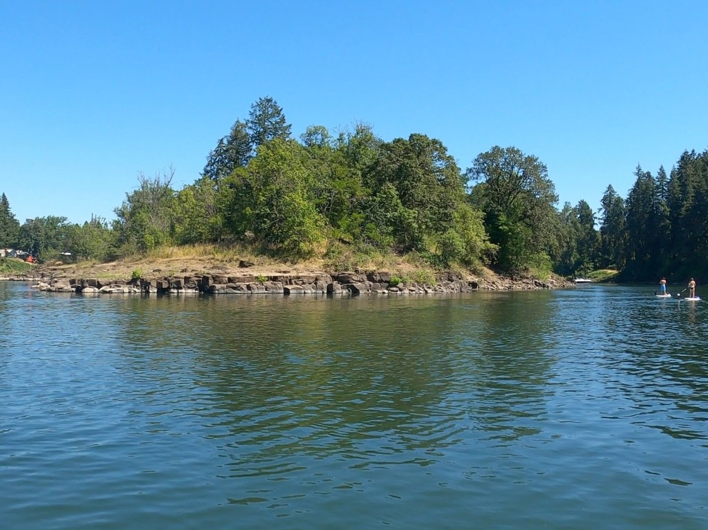
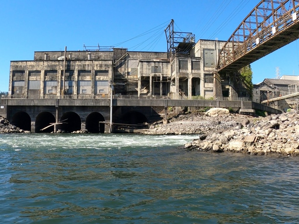
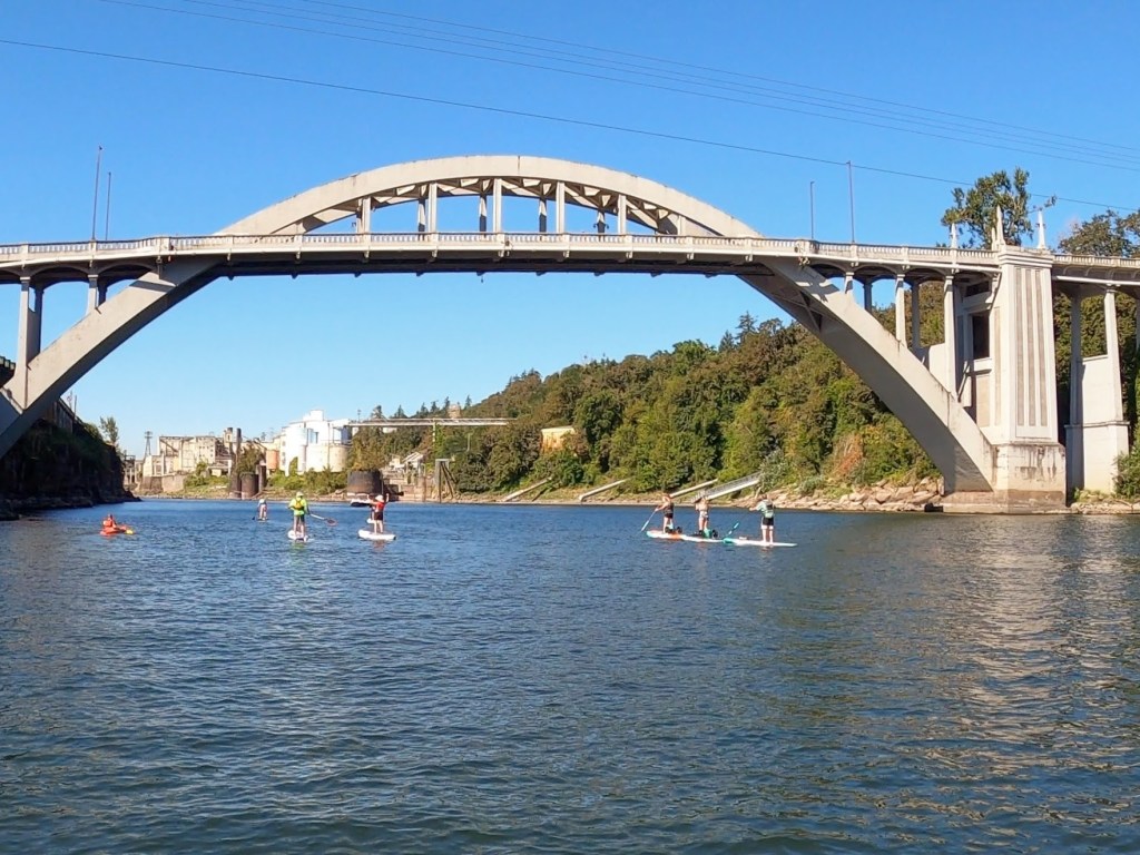
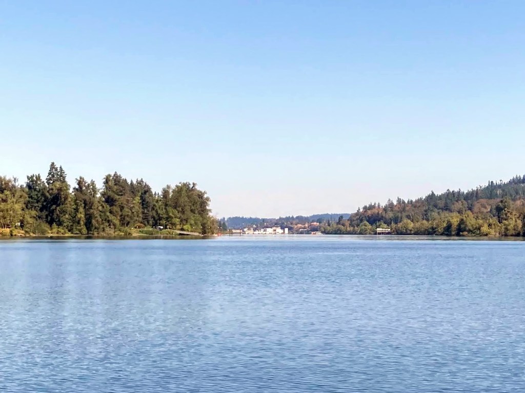
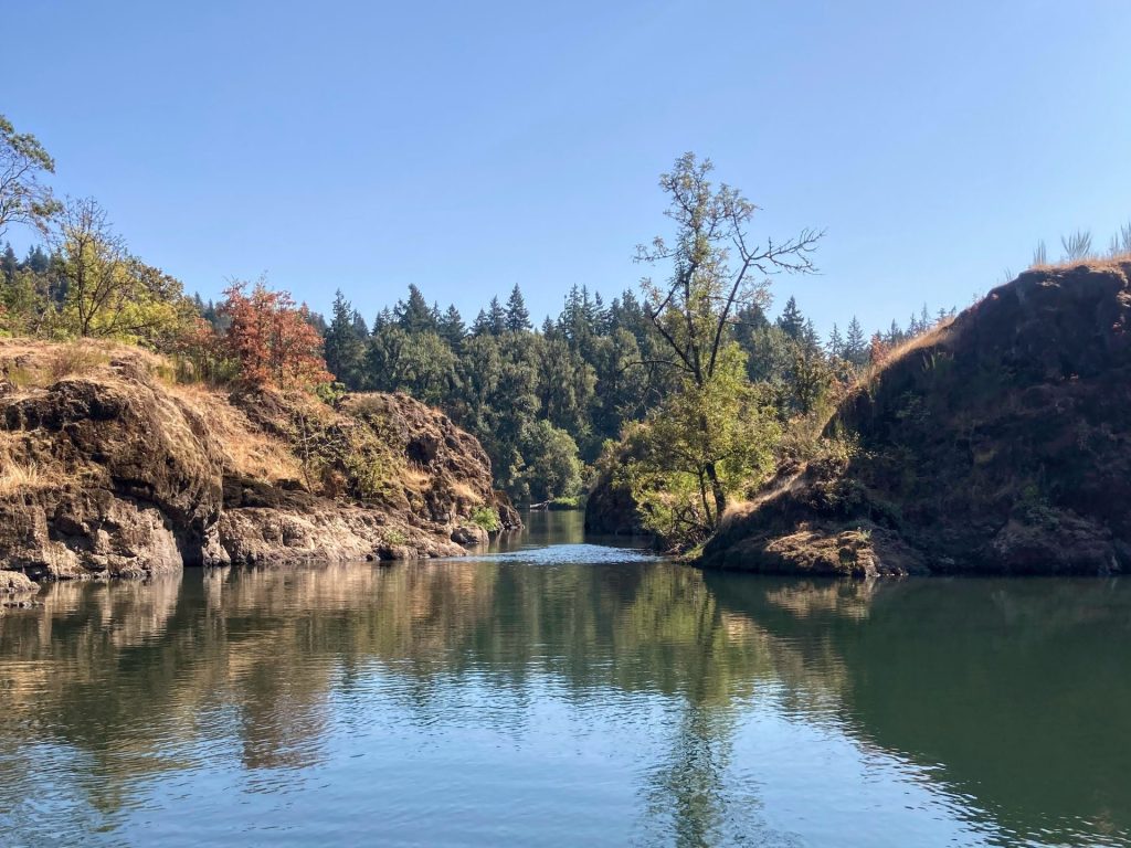
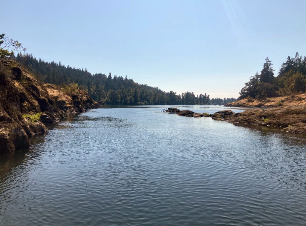
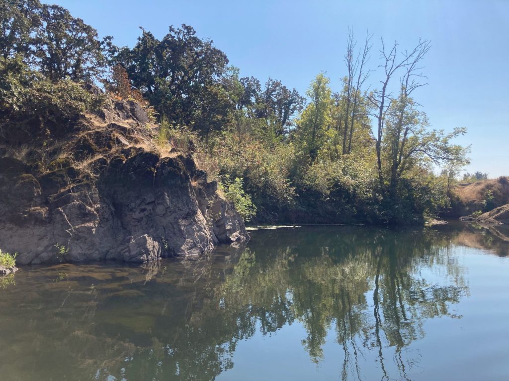
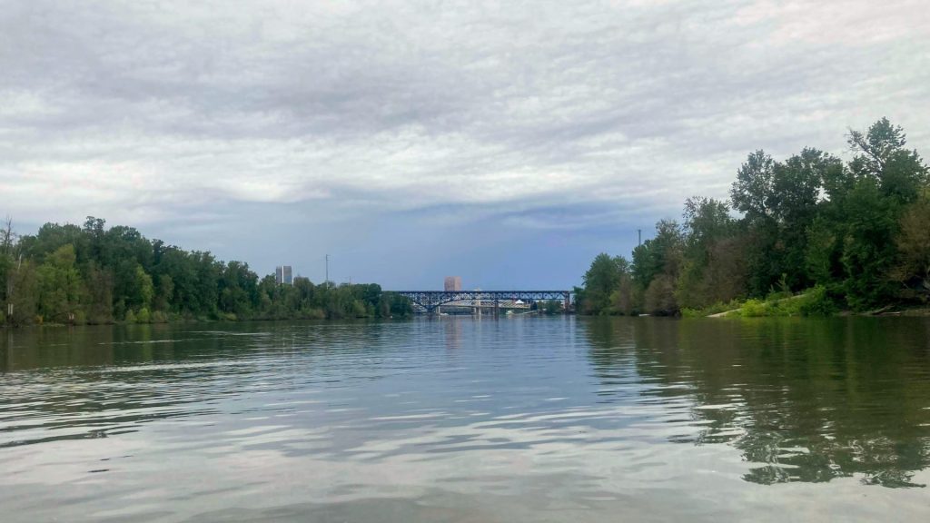
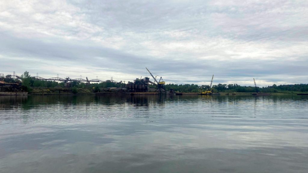
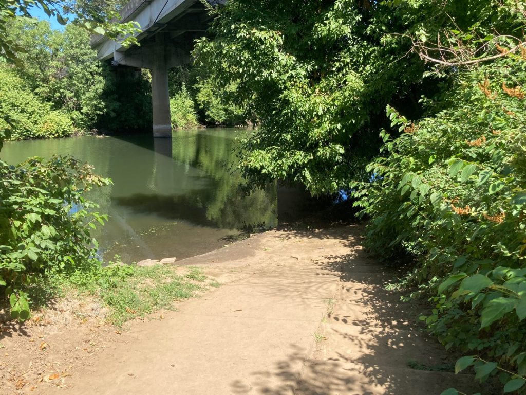
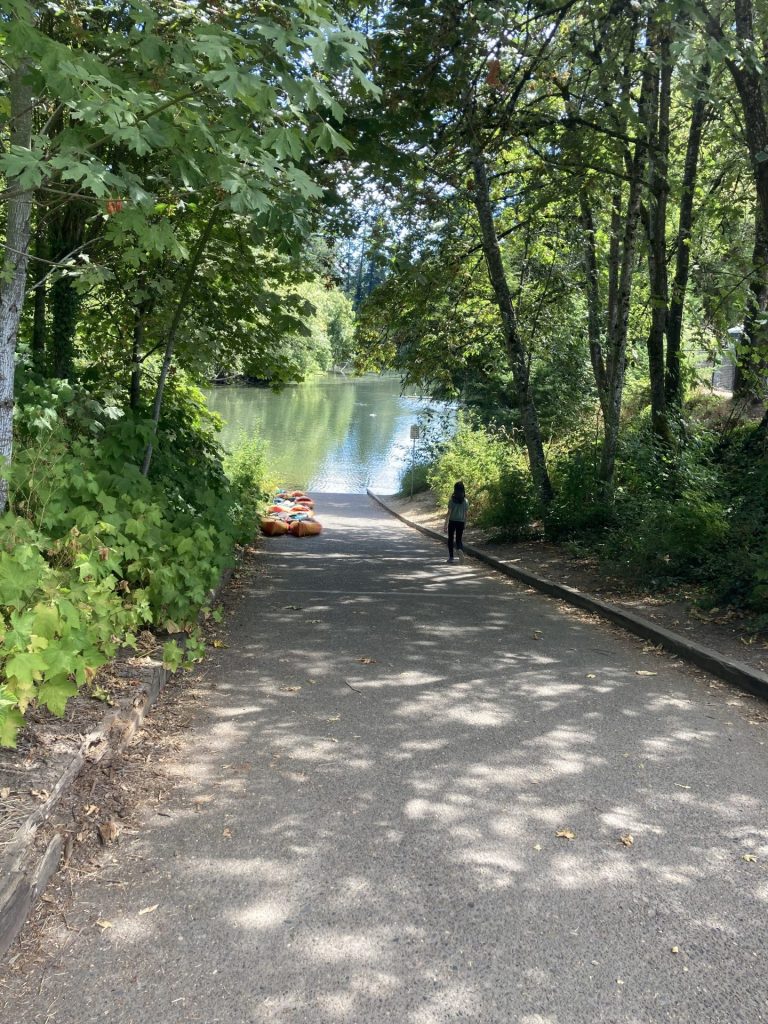
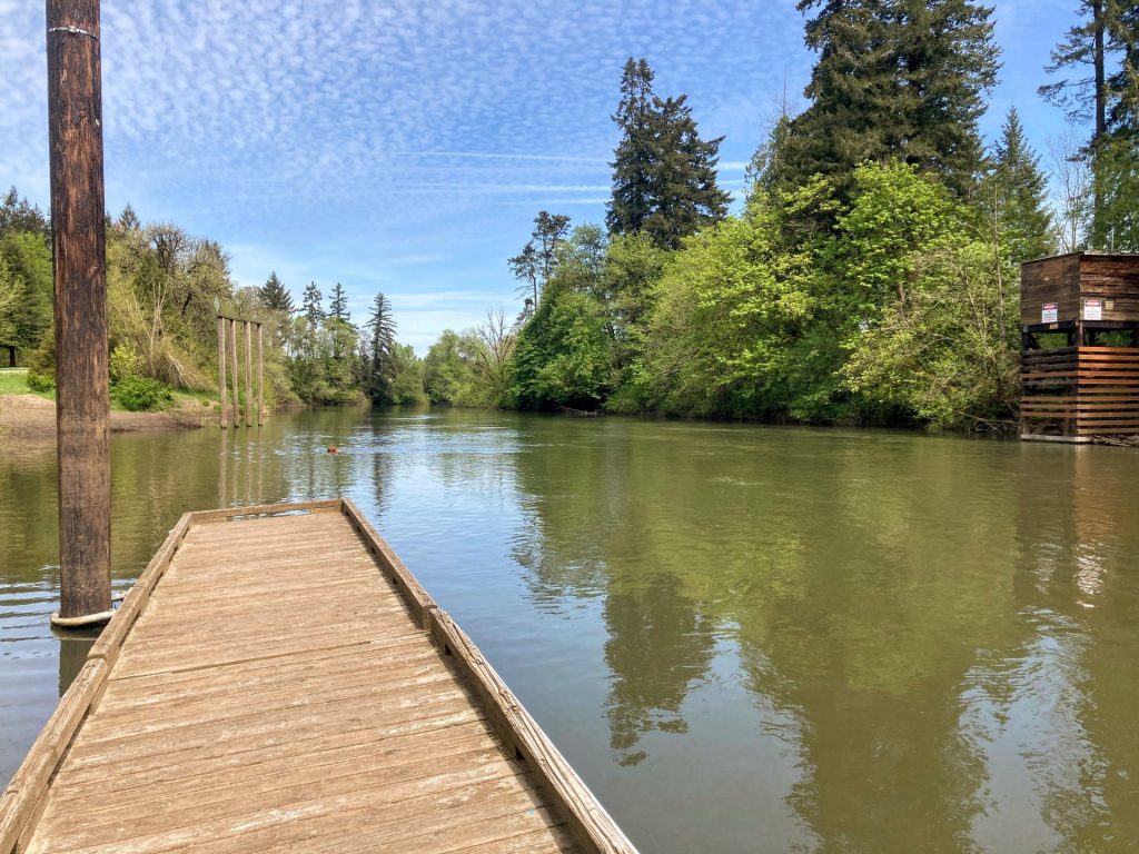
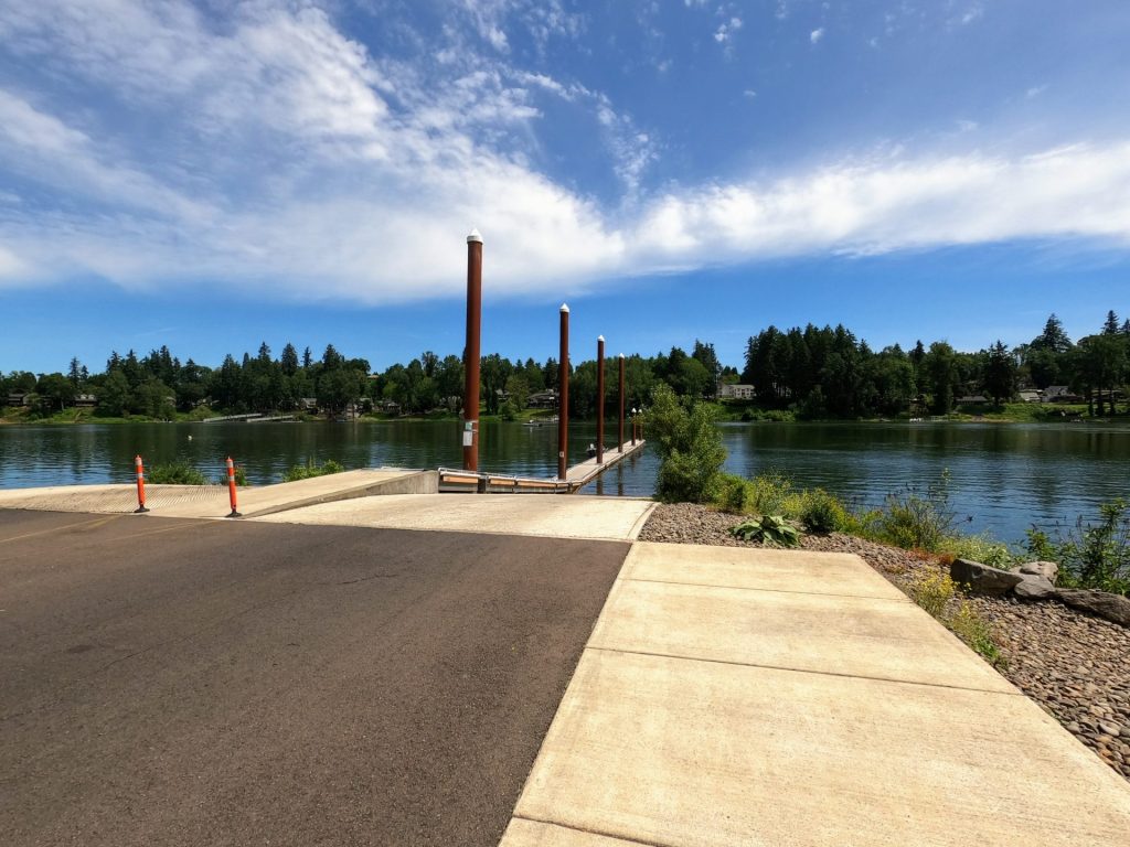
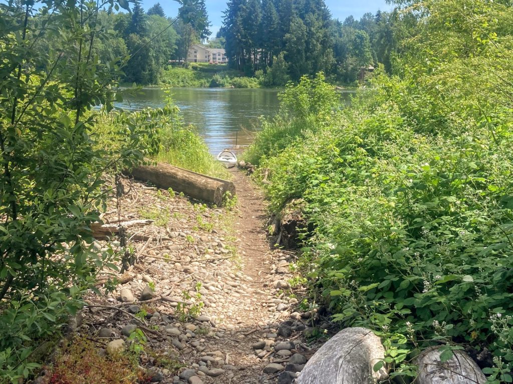
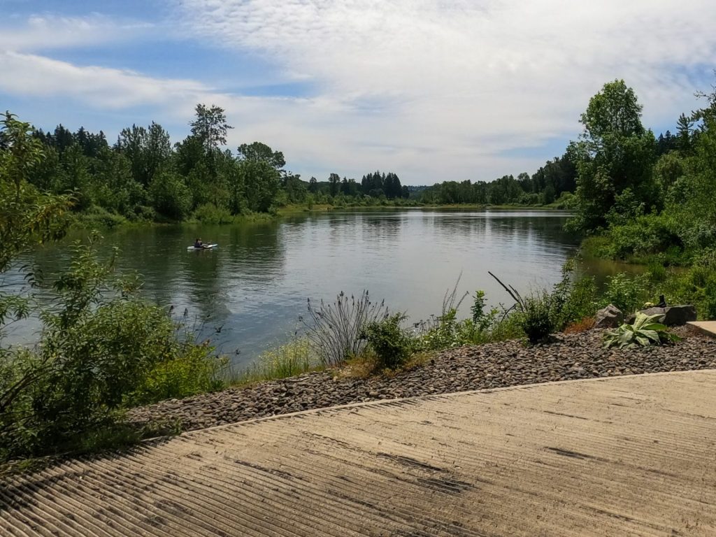
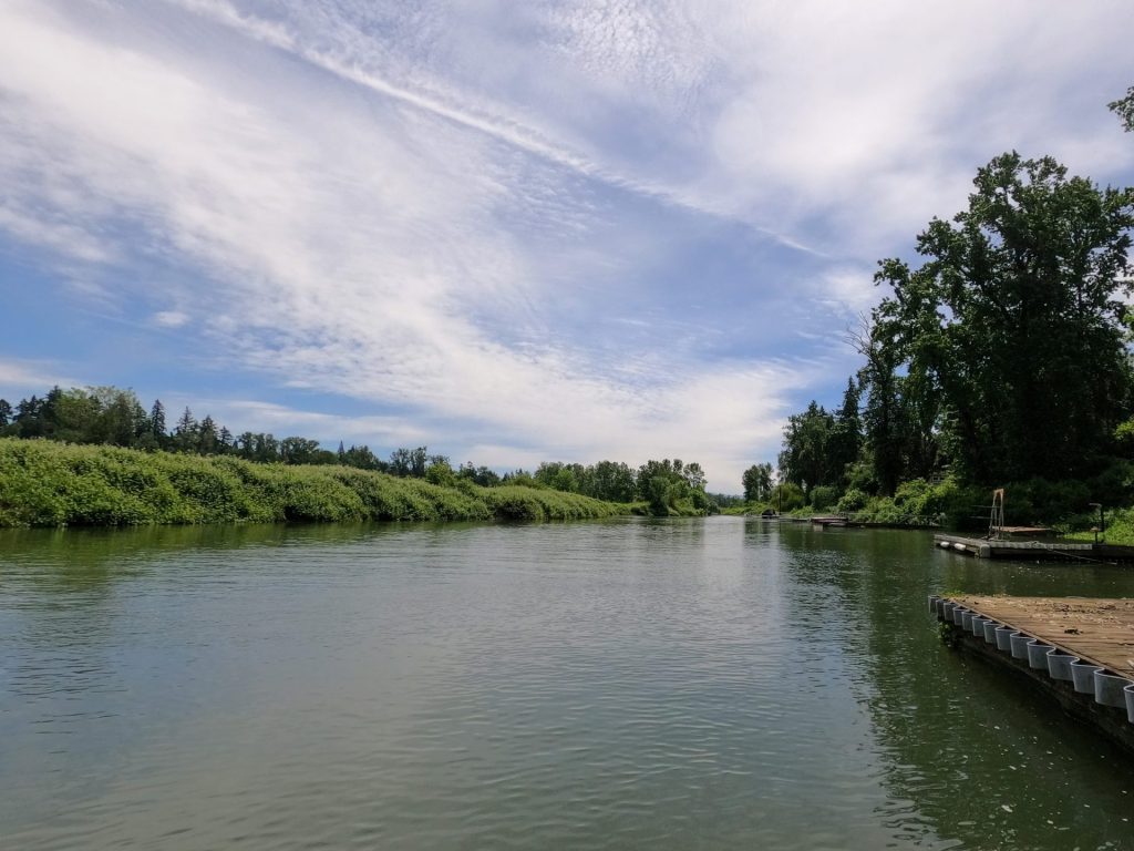
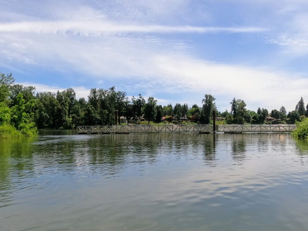
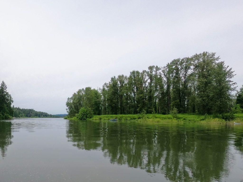
The Cedaroak boat ramp in West Linn is a popular launching point on the Willamette River. On a warm sunny day, you may see anglers hanging out by the dock, powerboats and personal watercraft roaring along the mainstem, and paddlers playing around in the adjacent lagoon or heading out to Goat Island and beyond.

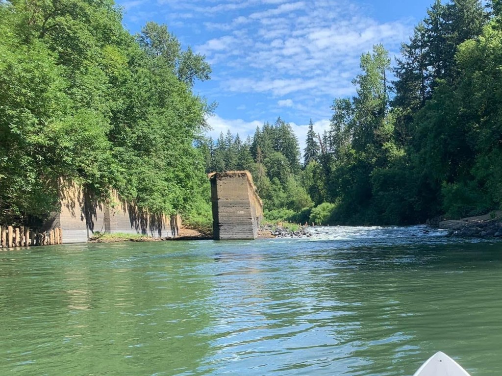
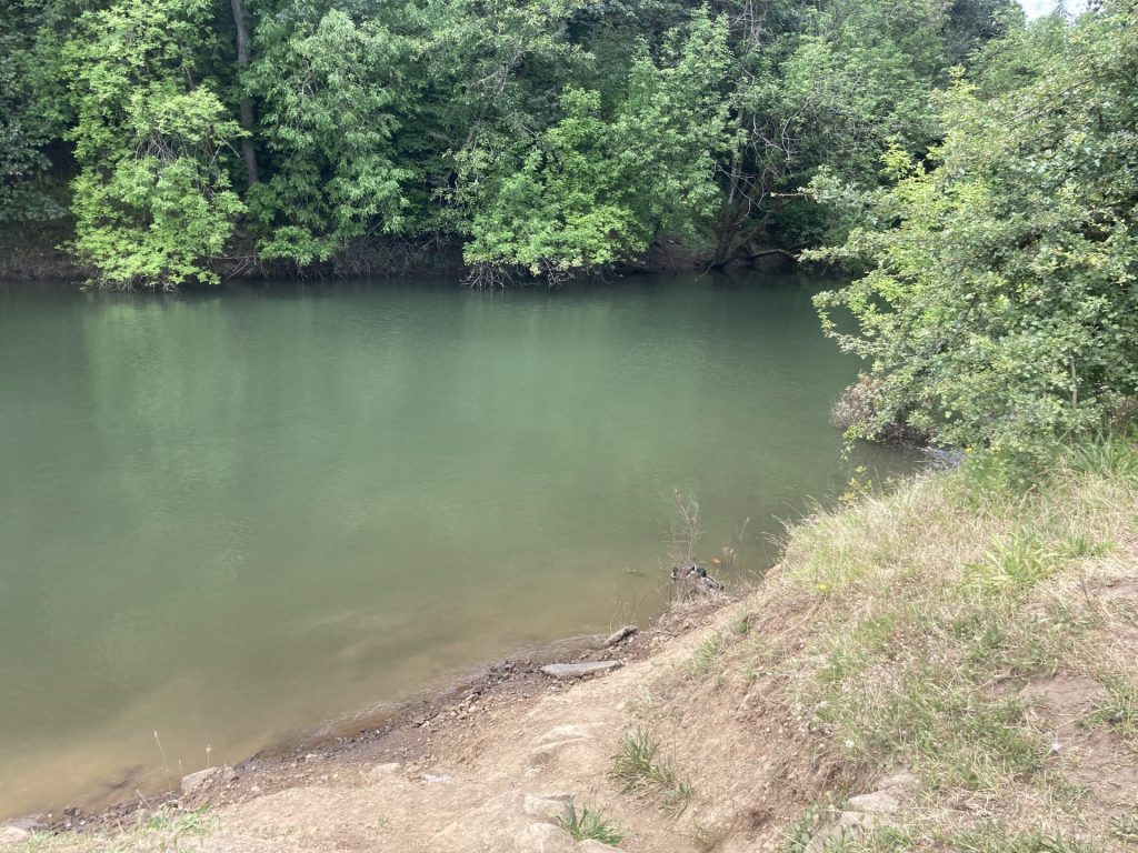
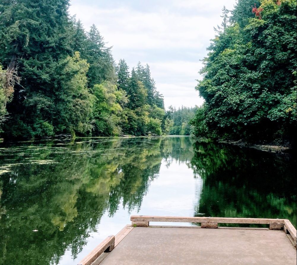
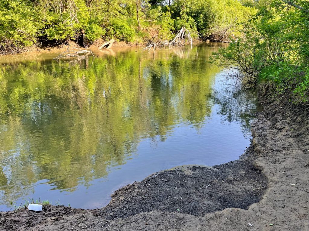
Paddling from the Cedaroak boat ramp to Goat Island provides just enough connection to nature while maintaining the conveniences of an urban paddle. Beginners and families may also enjoy just playing around in the protected lagoon of Cedar Island.

Good to know:

  • The cellular reception is fair here.
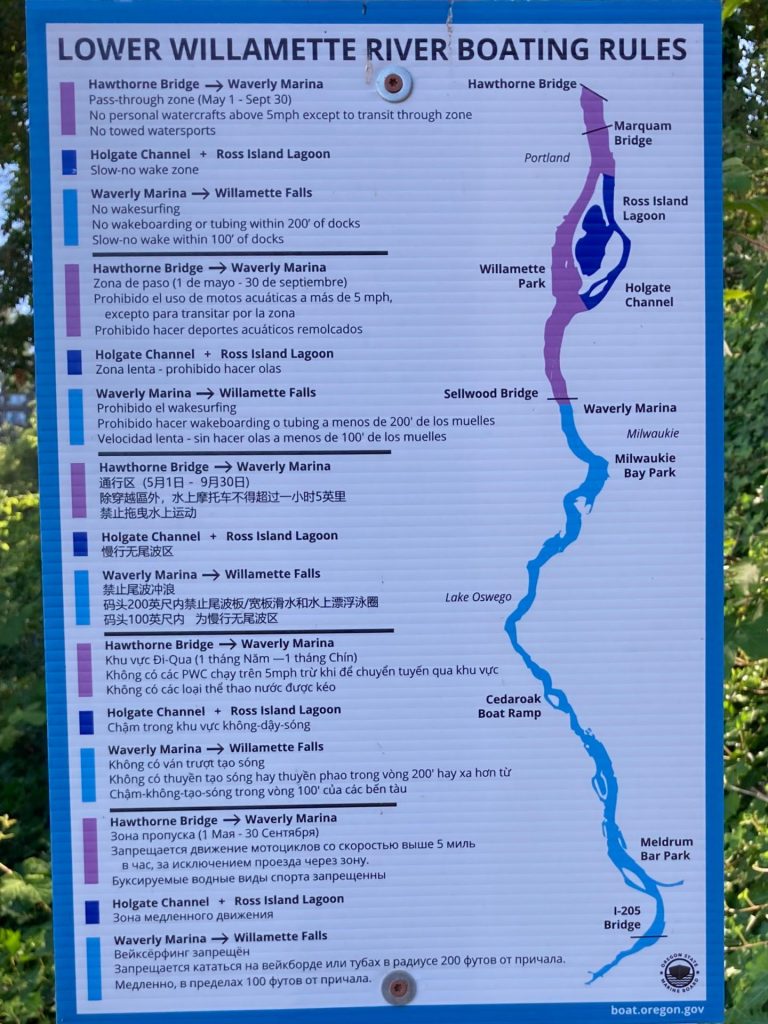
  • At higher flows in the winter and spring, this route may not be suitable for an out-and-back paddle. Please check conditions before getting on the water.
  • The area inside Cedar Island lagoon is a slow-no wake zone.
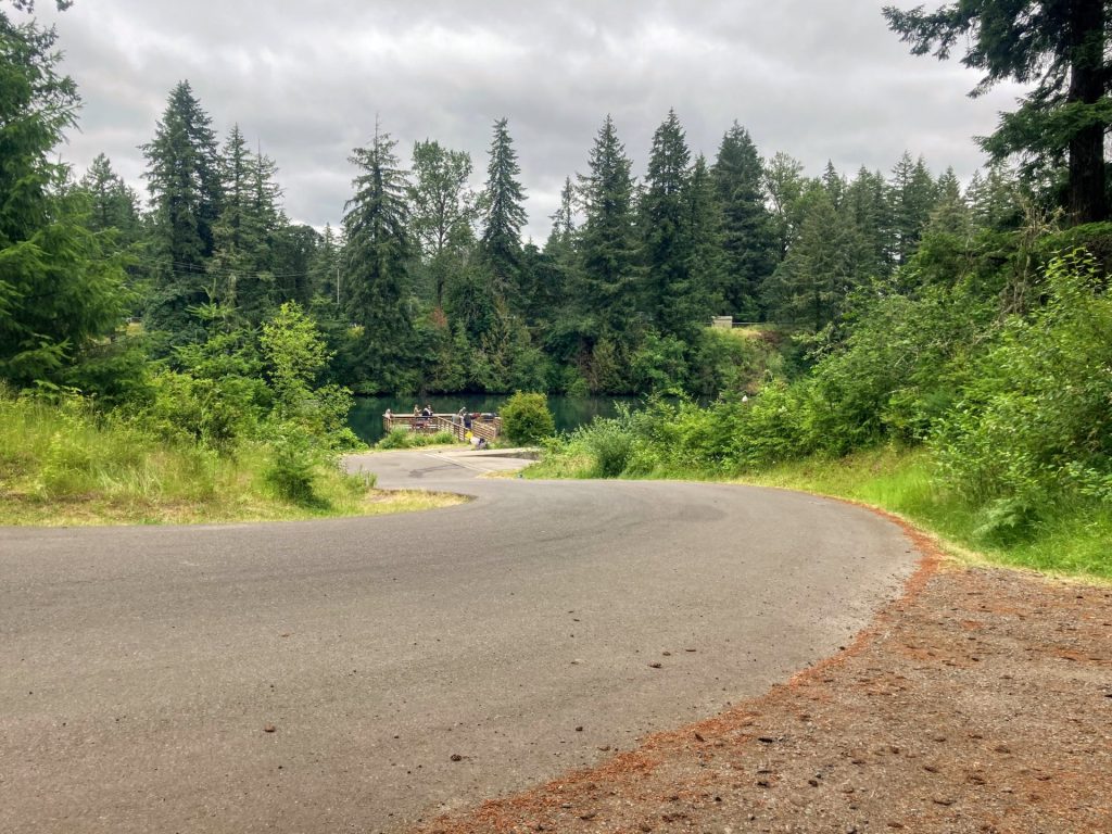
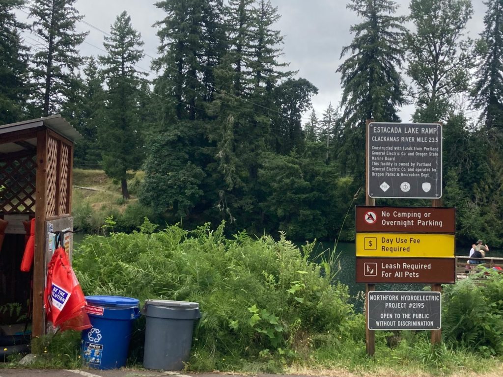
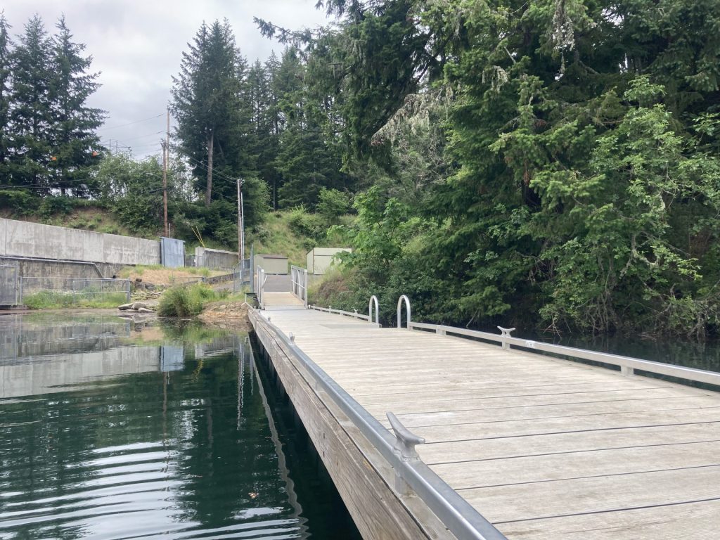
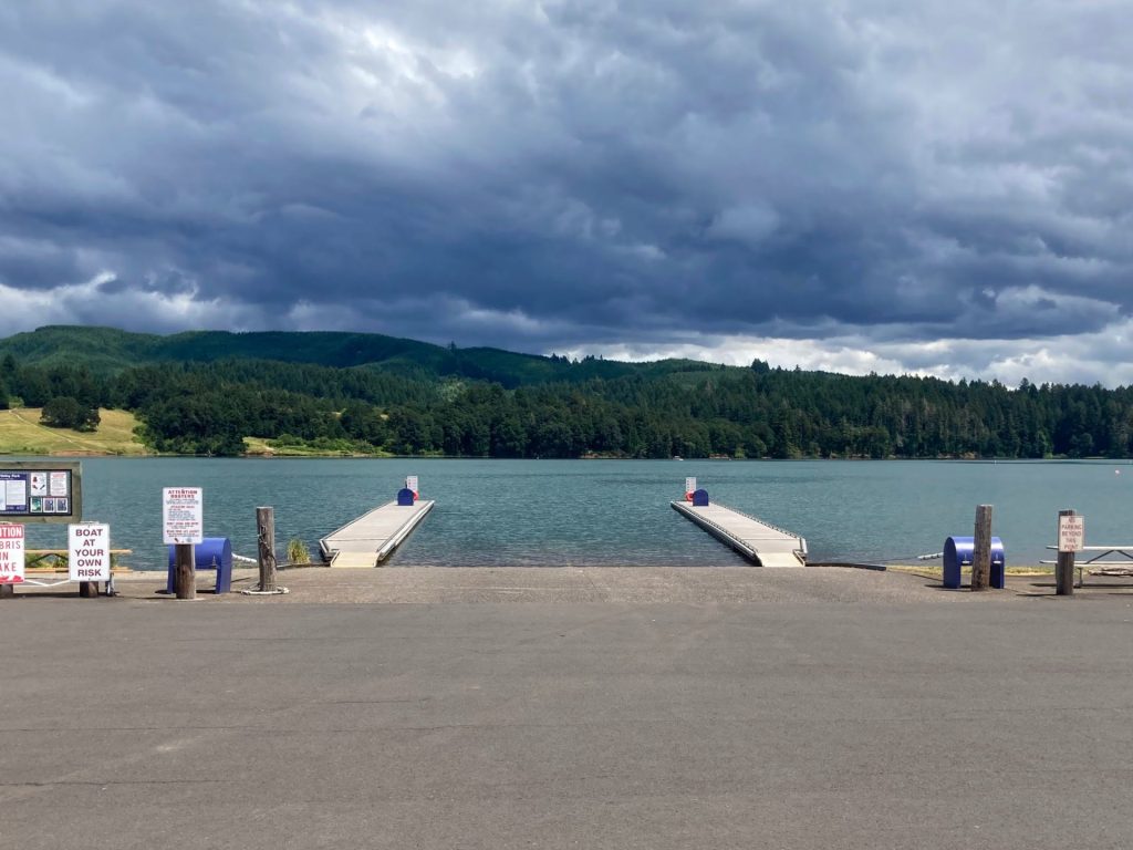
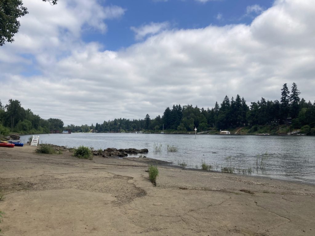
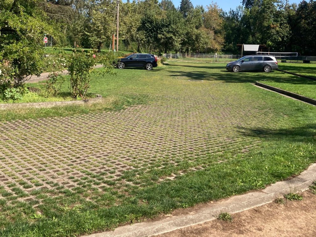
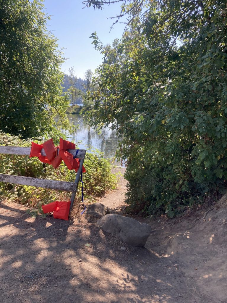
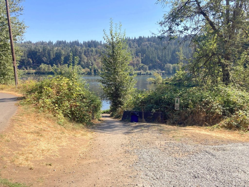
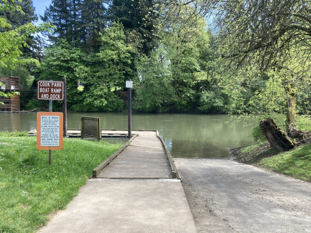
Cedaroak boat ramp

  • Parking fee: free
  • Launch type: boat ramp, dock, beach
  • Restrooms: flush
  • Open: year-round

The boat ramp access is managed by the City of West Linn. Contact info 503-557-4700

Driving Directions:

Additional things to do:

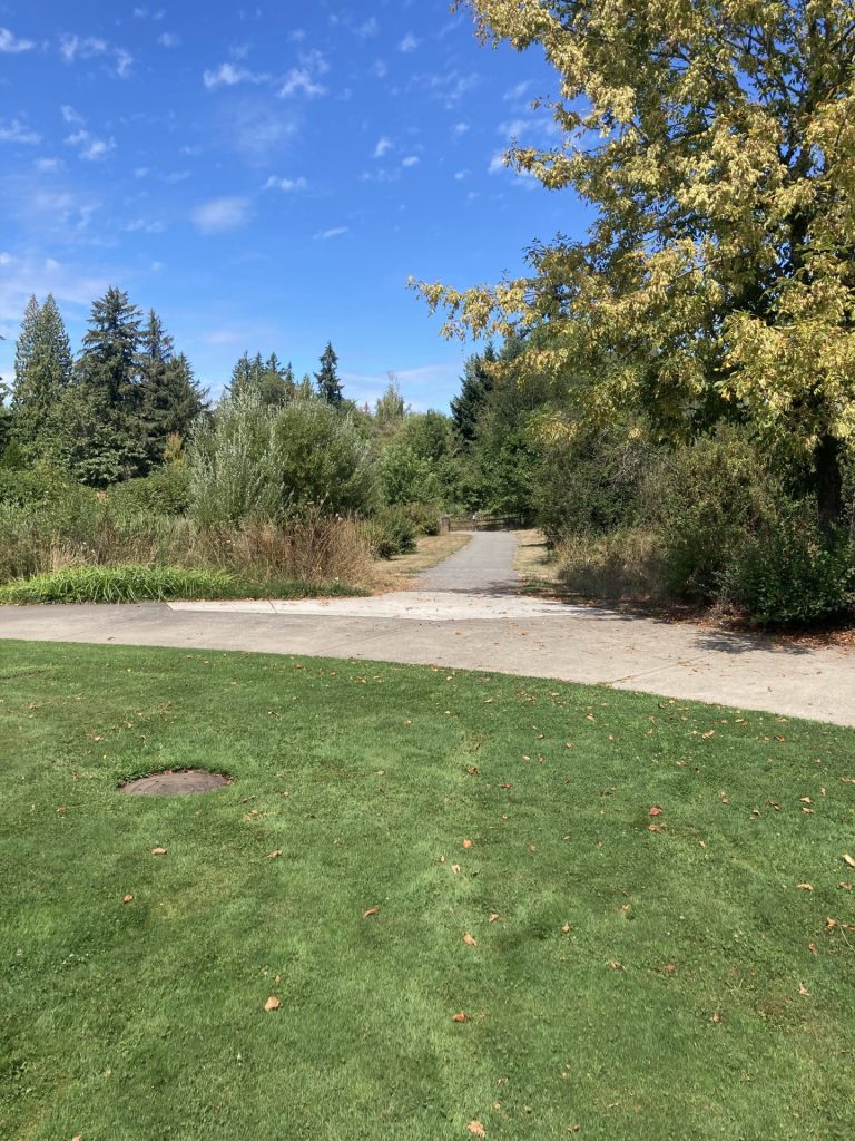
  • visit nearby Mary S. Young Park which has wooded trails leading to the river and to Cedar Island.
  • Consider starting at other launch sites along the Willamette River.

Check before you go:

  • Maps and Suggested Routes: Download or print out a map before you go from the SWT Planner App. As a premium member, you can access an ever-growing library of paddling-related maps and suggested routes.
  • Weather: Check the weather forecast and check the wind conditions.
  • Toxic algae blooms: This temporary condition occurs at some of the area lakes in the summer and may affect your health if water or fish is consumed during these conditions. Get more info on how to tell if algae is harmful and watch for water advisories but also use common sense if you see water that doesn’t look right.
  • Inspect your watercraft. You can help prevent the spread of aquatic invasive species by wiping off any vegetation or debris from your watercraft and making sure it is dry each time before entering a new waterway.
  • PFD, Whistle, and Waterway Access Permit: In Oregon, all paddlecraft 10′ or longer (including SUPs, kayaks, and canoes) require a permit. You can purchase the permit online.

Beware that the routes and information on this site are just general guides and the best path may vary based on water level, obstructions, experience level, equipment, and other conditions. Paddlers are responsible for providing their own safety. Super Water Trails does not assume any liability.

Estacada Lake

Skip ahead to check conditions

Estacada Lake, located about 40 minutes drive southeast of Portland, is a favorite for many paddlers. It is a “run-of-the-river” reservoir of the Clackamas River managed by PGE for hydroelectric power. The paddle feels very special as you paddle through tall forested canyons, visit gushing waterfalls, and listen for the sound of dripping water. Of note, larger powerboats and PWCs mostly avoid this lake due to the narrow waterway and thus it is very popular for SUPs, kayaks, and smaller boats.

This is considered a beginner-friendly paddle under typical conditions. First-time visitors to Estacada Lake, however, may be surprised by how cold the water is. It reaches only into the 60s during the summer months. You can check on the latest water temperature below.

There are 2 main launch sites at Estacada Lake, Milo McIver State Park and Timber Park. Both are located next to the dam but on opposite sides of the lake. The Milo McIver day-use area is open year-round and requires a state parks pass or day-use fee, while the main launch at Timber Park is open seasonally and requires (in 2024) a PGE Parks pass or day-use fee.

Paddle in the southeast direction away from the River Mill Dam (From Timber Park, go LEFT; from Milo McIver, go RIGHT). It soon narrows to about 300 ft. or less in some sections. Watch or listen for waterfalls and find some coves to play in.

If you paddle beyond the bridge, the crowds thin out and there is a larger waterfall on the left you don’t want to miss. There are also more coves to observe in this section. As you get closer to the turnaround point, the current picks up and you will pass some large rock islands.

Good to Know:

  • Arrive early, as parking may be difficult to find in the summertime, especially on weekends.
  • There are no special waterway speed restrictions for Estacada Lake.
  • The cellular reception is good here.

Launch sites:

Milo McIver boat ramp

  • Parking fee: day use fee (purchase on site) or Oregon State Parks pass
  • Launch type: ADA kayak dock, boat ramp
  • Restrooms: vault
  • Open: year-round

Driving Directions:

After you enter the park, follow the road to the right, pass the horse arena, then pass a campground, then turn right on S River Lake Road, and go to the end of the road.

Timber Park

  • Parking fee: Beginning in 2024, a $5 parking pass will be required at Timber Park from May 1 to October 15. A season pass will be available for $40. Contact PGE Parks for details.
  • Launch type: boat ramp, dock, primitive bank
  • Restrooms: near the ball field
  • Open: seasonal, 5/1- 10/15
Timber Park dock

Alternative launch sites

At Timber Park, there are a couple of smaller hand launch sites as noted on the map provided by PGE (see map download). There is one behind the ball field and also one on Tulip Road.

Driving Directions:

For Timber Park, drive past the disc golf course and find the parking lot to the left.

Additional things to do:

  • Camp at the Milo McIver State Park campground.
  • Hike on miles of hiking trails at the Milo McIver state park. Also, the nation’s 2nd largest yew tree is located here.
  • Play disc golf? There are disc golf courses at Milo Mc Iver SP and Timber Park, both highly rated in Oregon.

Check before you go:

  • Maps and Suggested Routes: Download or print out a map before you go from the SWT Planner App. As a premium member, you can access an ever-growing library of paddling-related maps and suggested routes.
  • Park Updates: For Milo McIver State Park, check the Oregon State Parks website for more info and for Timber Park call the PGE Parks Information Line at 503-464-8515.
  • Check the water level and flow: closures may occur when it reaches flood stage
  • Inspect your watercraft. You can help prevent the spread of aquatic invasive species by wiping off any vegetation or debris from your watercraft and making sure it is dry each time before entering a new waterway.
  • PFD, Whistle, and Waterway Access Permit: In Oregon, all paddlecraft 10′ or longer (including SUPs, kayaks, and canoes) require a permit. You can purchase the permit online.

Beware that the routes and information on this site are just general guides and the best path may vary based on water level, obstructions, experience level, equipment, and other conditions. Paddlers are responsible for providing their own safety. Super Water Trails does not assume any liability.

Henry Hagg Lake

Skip ahead to check conditions

Henry Hagg Lake is a reservoir located in the Coast Range foothills that is used for irrigation, municipal water, and improving the water quality of the Tualatin River downstream. At just under 40 miles west of Portland many residents in the northern Willamette Valley area visit this lake regularly for water recreation, especially in the summertime.

Scoggins Valley Park surrounds Hagg Lake with two boat ramps and multiple park recreation areas along a forested shoreline. The most popular and most convenient access for paddlers is known as Boat Ramp C. At this location, families or groups have generous parking, plenty of shoreline access, picnic tables, restrooms, and seasonal on-site rentals. And most importantly, this area is within the 10 mph speed restriction zone of the lake. Many first-timers or early beginners start off here. There are also quiet coves to explore within the no-wake zone.

Good to Know:

By May and June, the water temperature can rise above 60F while nearby paddling spots such as the Willamette River and Estacada Lake are still only in the 50’s. By summer, the water reaches upper 70s, warm enough for swimming. However, watch out for mudflats when the water level drops in late summer or fall (you can check the water level below).

The cellular reception is only fair or poor here.

Additional Information:

The water at Hagg Lake is known for being muddy, which is attributed to the high clay content soil bottom. Also, when the water level gets low in late summer or fall, you may get a view of the man-made concrete structures placed at the bottom of the lake. These structures are made of plastic pipe “tentacles” and concrete cinder block anchors and take the place of submerged trees that usually provide shelter for fish.

Put-In Locations:

  • Parking fee: $7 at entrance or annual pass
  • Launch type: boat ramp, dock, shoreline
  • Restrooms: flush
  • Open: year-round
From Washington County Parks
Boat Ramp C

Driving Directions:

Scoggins Valley Park is at 50250 SW Scoggins Valley Rd., Gaston OR 97119.

From State Highway 47, turn onto SW Scoggins Valley Road. Once you pass the fee booth, turn left onto W Shore Drive. Follow until you reach Boat Ramp C on right about 4 miles in.

Additional things to do:

In the summer, there may be events such as the free “Live at Hagg Lake” concert series. Also, visit the other recreation areas at Scoggins Valley Park for hiking, bicycling, fishing, or playing the disc golf course.


Check before you go:

  • Maps and Suggested Routes: Download or print out a map before you go from the SWT Planner App. As a premium member, you can access an ever-growing library of paddling-related maps and suggested routes.
  • Weather: Check the weather forecast for the area and check the wind conditions.
  • Parking: If you qualify for a discounted pass (55+ or veteran), purchase it ahead of time at the Park Office, Monday – Friday, 8 am – 4:30 pm (cash and card), or at Lake Stop Store 8015 SW Old Highway 47, Gaston, OR 97119 (card only).  
  • Water Temperature: Read the cold water safety page if you need more background info.
  • Toxic algae blooms: This temporary condition occurs at some of the area lakes in the summer and may affect your health if water or fish is consumed during these conditions. Get more info on how to tell if algae is harmful and watch for water advisories but also use common sense if you see water that doesn’t look right.
  • Inspect your watercraft. You can help prevent the spread of aquatic invasive species by wiping off any vegetation or debris from your watercraft and making sure it is dry each time before entering a new waterway.
  • PFD, Whistle, and Waterway Access Permit: In Oregon, all paddlecraft 10′ or longer (including SUPs, kayaks, and canoes) require a permit. You can purchase the permit online.

Beware that the routes and information on this site are just general guides and the best path may vary based on water level, obstructions, experience level, equipment, and other conditions. Paddlers are responsible for providing their own safety. Super Water Trails does not assume any liability.

Yamhill River Locks

Skip ahead to check conditions

The Yamhill River drains the North Coast Range and slows down to barely a crawl in the summer and fall before emptying into the Willamette River near Newberg. This provides the opportunity for an easy, beginner-friendly, out-and-back paddle from Dayton where you can paddle up to the remnants of the Lafayette Locks (aka Yamhill Locks), an important part of early Yamhill County history. There are mostly SUPs, kayaks, canoes, and small motorboats here. The narrow waterway about 100ft wide and snag hazards keeps the larger boats away.

A little history

In the late 1800s, steamboats transported vital materials such as wheat and lumber from Portland to McMinnville on the Yamhill River. The lock and dam project at Lafayette would allow ships going upstream to pass even during the dry summers.

First steamboat passage through Lafayette Lock
Unknown author – Oregon Historical Quarterly, Vol 91, No. 2 (Summer, 1990), cover page

This was highly contested by engineers though due to the dramatic rise and drop in water elevation on the Yamhill River. Nevertheless, it was eventually completed in 1900. Sadly, in the years after its completion, winter and spring floods would result in water rising above the lock and dam, which made the lock useless and the dam a navigational hazard. These problems limited its utility and more importantly, the interest of businesses. The lock ceased operations and was eventually blasted in 1950 in order to allow for native fish migration.

Good to Know:

  • The best times to paddle this route are usually between May through October. Outside of these months, you may encounter higher flows, dangerous logjams, and colder water temperatures.
  • The cellular reception is average here.

Launch Site:

Dayton Landing

  • Parking fee: no fee
  • Launch type: boat ramp
  • Restrooms: none
  • Open: year-round

Parking: Dayton Landing is a very small park managed by Yamhill County Parks. It has a gravel parking lot and a small boat ramp. It can be a little tricky to find so I’ve included coordinates.

Driving Directions:

GPS coordinates to gravel parking lot 45.22194, -123.07102

Before- OSU Special Collections & Archives: Commons
Original Collection: Gerald W. Williams Collection
After- taken July 2022

Photo Gallery:

Additional Things to Do:


Check before you go:

  • Maps and Suggested Routes: Download or print out a map before you go from the SWT Planner App. As a premium member, you can access an ever-growing library of paddling-related maps and suggested routes.
  • Inspect your watercraft. You can help prevent the spread of aquatic invasive species by wiping off any vegetation or debris from your watercraft and making sure it is dry each time before entering a new waterway.
  • PFD, Whistle, and Waterway Access Permit: In Oregon, all paddlecraft 10′ or longer (including SUPs, kayaks, and canoes) require a permit. You can purchase the permit online.

Beware that the routes and information on this site are just general guides and the best path may vary based on water level, obstructions, experience level, equipment, and other conditions. Paddlers are responsible for providing their own safety. Super Water Trails does not assume any liability.

George Rogers Park

Skip ahead to check conditions

George Rogers Park in Lake Oswego provides access to the Willamette River for SUPs, kayaks, and any other paddlecraft you can carry in. On hot summer days, the diminutive beach fills up with families and the boat ramp receives plenty of entry and exit traffic. From George Rogers Park, you can paddle up to Hog Island or further to Cedaroak Lagoon where you can pull over for a picnic or some playing around in the water. Early beginners and children, however, may be more comfortable with staying in the nearby Oswego Creek which is located adjacent to the beach.

Good to know:

  • Prepare to carry or wheel your gear 300- 500 ft or more depending on parking.
  • The cellular signal appears fair or good here.
  • If you don’t find parking here, consider looking for a spot near Roehr Park or Foothills Park. Both of these parks have hand carry boat launches and are less than 3/4 mile upstream from George Rogers Park.

Directions:

Additional things to do:

Get to know Lake Oswego’s gritty past by checking out the Iron Heritage Trail. One of the sites is the large can’t-miss-it iron furnace at George Rogers park. It was the first iron furnace to be built on the West Coast and was part of a large enterprise for pig iron production in the 1860s. You can drive, walk, and even paddle up to some of the other sites on the Iron Heritage Trail.

iron furnace at george rogers park
By Another Believer – Own work, CC BY-SA 4.0, https://commons.wikimedia.org/w/index.php?curid=69339878

Check before you go:

  • Maps and Suggested Routes: Download or print out a map before you go from the SWT Planner App. As a premium member, you can access an ever-growing library of paddling-related maps and suggested routes.
  • Water Temperature: Read the cold water safety page if you need more background info.
 USGS Water-data graph for site 14211720
  • Check Water Flow: Take caution with paddling on the river at higher flow. The usual slow summer rate is <1 ft/sec.
 USGS Water-data graph for site 14211720
 USGS Water-data graph for site 14211720
  • PFD, Whistle, and Waterway Access Permit: In Oregon, all paddlecraft 10′ or longer (including SUPs, kayaks, and canoes) require a permit. You can purchase the permit online.

Beware that the routes and information on this site are just general guides and the best path may vary based on water level, obstructions, experience level, equipment, and other conditions. Paddlers are responsible for providing their own safety. Super Water Trails does not assume any liability.

Willamette Falls

Skip ahead to check conditions

The Willamette Falls in Oregon City is actually the largest waterfall by volume in the Northwest and second only to the Niagara Falls in the United States. It has played an important role in the early development of Oregon, from providing the local tribes with fish and lamprey to harnessing its power for hydroelectricity and the operation of paper mills. Today, when you paddle along this section of the Willamette River you can get an idea of these myriad historic activities- with the canal and locks, the paper mills, and the power stations- juxtaposed with the natural beauty of this horshoe-shaped waterfall.

Good to Know:

  • Best time to visit is June-Oct. Watch for higher water flows outside of these months.
  • The cellular reception here is good or excellent

Launch Sites:

Sportcraft Landing/ eNRG Kayaking

  • Parking fee: none
  • Launch type: 2-lane boat ramp, dock
  • Restrooms: on-site
  • Open: year-round
  • On-site rentals at eNRG Kayaking are available, if needed

Driving Directions:

credit: Bob Heims, U.S. Army Corps of Engineers – U.S. Army Corps of Engineers Digital Visual Library, Public Domain

Check before you go:

  • Maps and Suggested Routes: Download or print out a map before you go from the SWT Planner App. As a premium member, you can access an ever-growing library of paddling-related maps and suggested routes.

[ventus width=”100%” height=”300px” radius=”10px” lat=”45.305″ lon=”-122.610″ zoom=”11″ layer=”wind” scale=”F” units=”mph” marker=”true” forecast=”true” time=”now].

  • Water Temperature: Read the cold water safety page if you need more background info.
 USGS Water-data graph for site 14153500
  • Water levels:
 USGS Water-data graph for site 14207770
  • Inspect your watercraft. You can help prevent the spread of aquatic invasive species by wiping off any vegetation or debris from your watercraft and making sure it is dry each time before entering a new waterway.
  • PFD, Whistle, and Waterway Access Permit: In Oregon, all paddlecraft 10′ or longer (including SUPs, kayaks, and canoes) require a permit. You can purchase the permit online.

Beware that the routes and information on this site are just general guides and the best path may vary based on water level, obstructions, experience level, equipment, and other conditions. Paddlers are responsible for providing their own safety. Super Water Trails does not assume any liability.

North Fork Reservoir

Skip ahead to check conditions

North Fork Reservoir in Estacada is lined by narrow steep canyons in the foothills of the Cascade mountains. It is one of several reservoirs along the Clackamas River, such as Estacada Lake, which were built to provide hydroelectric power. The water runs clear and cold here. At less than an hours’ drive from Portland, it is a popular place for paddling, as well as boating, waterskiing, and fishing. Paddlers who want to avoid boat wake can go up the inlet that is south of Promontory Park or paddle around by the culvert.

Good to know:

Put-In Locations:

Promontory Park Marina

  • Parking fee: none
  • Launch Type: kayak dock, boat ramp
  • Restrooms: flush

There is a large paved parking lot with a lot of parking spaces for trailers. A convenience store with boat rentals is also located here.

Directions:

From Estacada OR-224E, after passing E. Faraday Road, turn right at the Promontory Park sign. Then follow the road to the right for the marina.

The Culvert

  • Parking fee: none
  • Launch Type: shore
  • Restrooms: none

The parking lot has space for about 25 cars and faces the shoreline. This area is in a slow-no wake zone.

Directions:

From Estacada OR-224E, soon after passing East Faraday Road (North Shore ramp), look for the turnout on the left. Turn left and proceed to small paved parking lot by the culvert.

North Shore Ramp

  • Parking fee: none
  • Launch Type: boat ramp
  • Restrooms: flush

This parking lot is large and has room for trailers. It is the closest boat ramp coming from Estacada, but it is located on the busy main portion of the lake where there is no speed restriction.

Directions:

From Estacada OR-224E, turn right on E. Faraday Road. Proceed to parking lot on the left.

Additional things to do:


Check before you go:

  • Maps and Suggested Routes: Download or print out a map before you go from the SWT Planner App. As a premium member, you can access an ever-growing library of paddling-related maps and suggested routes.
  • Water Temperature: Read the cold water safety page if you need more background info.
 USGS Water-data graph for site 14210000
  • Inspect your watercraft. You can help prevent the spread of aquatic invasive species by wiping off any vegetation or debris from your watercraft and making sure it is dry each time before entering a new waterway.
  • PFD, Whistle, and Waterway Access Permit: In Oregon, all paddlecraft 10′ or longer (including SUPs, kayaks, and canoes) require a permit. You can purchase the permit online.

Beware that the routes and information on this site are just general guides and the best path may vary based on water level, obstructions, experience level, equipment, and other conditions. Paddlers are responsible for providing their own safety. Super Water Trails does not assume any liability.

Willamette River Narrows

Skip ahead to check conditions

The Willamette River “Narrows” in West Linn is a popular paddling destination. It is defined by a cluster of basalt islands that are located just a few miles upstream from the dramatic basalt cliffs at the well-known Willamette Falls. In late summer and early fall, when the water level and flow are just right, paddlers can enjoy an easy out-and-back paddle to the Narrows.

Good to Know:

  • Cellular reception is good or excellent here.
  • The best time to visit is late summer or early fall.
  • Watch for stronger current and turbulence at winter and spring flows.
  • Watch out for powerboat traffic on the river and stay to the side.

Launch sites:

Willamette Park (West Linn)

  • Parking fee: free
  • Launch type: beach
  • Restrooms: flush toilets near playground
  • Open: year-round

There is a grassy parking lot located behind Willamette Park in West Linn at 12th St. and Volpp St. It is about 100 ft carry distance from the parking lot to the beach launch. The access to the beach is via a sloped narrow dirt path, suitable for hand-carrying your gear.

There is also parking along the west end of Volpp St. which leads to a wider, more gradual path about 160 ft to the beach.

Driving Directions:

Bernert Landing

  • Parking fee: none
  • Launch type: boat ramp, dock
  • Restrooms: flush toilets
  • Open: year-round

This launch site is located directly on the Willamette River. Parking is primarily for trailers here.

Driving Directions:

Additional things to do:

  • To paddle up to the Willamette Falls, the 2nd largest waterfall in the Pacific Northwest, you would need to launch from a different point further downstream. There are several launches to choose from that are just a 5-mile drive away. See the post on Willamette Falls for more details.

Check before you go:

  • Maps and Suggested Routes: Download or print out a map before you go from the SWT Planner App. As a premium member, you can access an ever-growing library of paddling-related maps and suggested routes.
  • Weather: check that it is not too windy

[ventus width=”100%” height=”300px” radius=”10px” lat=”45.339″ lon=”-122.650″ zoom=”9″ layer=”wind” scale=”F” units=”mph” marker=”true” forecast=”true” time=”now].

  • Water Temperature: Read the cold water safety page if you need more background info.
 USGS Water-data graph for site 14197900
  • Check the water level: When it rises above 56 ft. the flow is usually more turbulent, especially in the rocky areas. At lower water levels, some places may not be passable.
 USGS Water-data graph for site 14207740
  • Toxic algae blooms: This temporary condition occurs at some of the area lakes in the summer and may affect your health if water or fish is consumed during these conditions. Get more info on how to tell if algae is harmful and watch for water advisories but also use common sense if you see water that doesn’t look right.
  • Inspect your watercraft. You can help prevent the spread of aquatic invasive species by wiping off any vegetation or debris from your watercraft and making sure it is dry each time before entering a new waterway.
  • PFD, Whistle, and Waterway Access Permit: In Oregon, all paddlecraft 10′ or longer (including SUPs, kayaks, and canoes) require a permit. You can purchase the permit online.

Beware that the routes and information on this site are just general guides and the best path may vary based on water level, obstructions, experience level, equipment, and other conditions. Paddlers are responsible for providing their own safety. Super Water Trails does not assume any liability.

Willamette River at Ross Island

Skip ahead to check conditions

Ross Island is a popular urban paddle destination on the Willamette River. Portland locals and visitors alike enjoy this convenient location. On any given day you may be sharing the busy waters with boaters, water-skiers, and the local rowing club.

This route starts and ends at Sellwood Riverfront Park. You could also start at Willamette Park, which is located a little closer to Ross Island.

Good to Know:

  • Be prepared to walk about 150 yards from the Sellwood Riverfront parking lot to the boat dock.
  • The best times to visit for a beginner-level paddle would generally be April-October.
  • At higher flow conditions, assess your ability and reserve some energy for the return as you would be paddling upstream on the way back.
  • The cellular reception here is very good or excellent.

Driving Directions:


Check Before You Go:

  • Maps and Suggested Routes: Download or print out a map before you go from the SWT Planner App. As a premium member, you can access an ever-growing library of paddling-related maps and suggested routes.
  • Weather: Check the weather forecast and pay attention to the wind.
  • Recent heavy rains?– check the Big Pipe status and avoid the Willamette River in this area if there is sewer overflow.
  • Toxic algae blooms: This temporary condition occurs at some of the area lakes in the summer and may affect your health if water or fish is consumed during these conditions. Get more info on how to tell if algae is harmful and watch for water advisories but also use common sense if you see water that doesn’t look right.
  • Water Temperature: Read the cold water safety page if you need more background info.
 USGS Water-data graph for site 14211720
  • Inspect your watercraft. You can help prevent the spread of aquatic invasive species by wiping off any vegetation or debris from your watercraft and making sure it is dry each time before entering a new waterway.
  • PFD, Whistle, and Waterway Access Permit: In Oregon, all paddlecraft 10′ or longer (including SUPs, kayaks, and canoes) require a permit. You can purchase the permit online.

Beware that the routes and information on this site are just general guides and the best path may vary based on water level, obstructions, experience level, equipment, and other conditions. Paddlers are responsible for providing their own safety. Super Water Trails does not assume any liability.

Tualatin River

Skip ahead to check conditions

The Tualatin River starts in the Coast Range and takes a sinuous path eastward through farmlands, wetlands, and urban areas. The stretch from Hillsboro to West Linn, almost 40 river miles, has been designated a National Water Trail with multiple access points. On a typical summer or fall day, the current is slow enough along this stretch to be paddled easily in either direction.

You can enjoy this water trail by starting at any one of the Tualatin or surrounding area locations described here. Most of these spots are quite busy during the summer due to the convenient in-town locations. You can expect to see many kayaks, paddleboards, canoes, and floaties out on the water. Also, families with kids and first-timers should feel comfortable here.

Good to Know:

  • During the rainy season, watch for increased flow which can create dangerous logjams.
  • Boating restrictions on this stretch of Tualatin River: no towed watersports.
  • Locations with summer rentals: Cook Park and Brown’s Ferry Park.
  • There is a diversion dam located just south of the I-205 overpass that should be avoided. It has been associated with some dangerous incidents and should be avoided.
  • There is a shallow area near Fanno Creek which may require a short portage over the rocks (between Cook Park and Tualatin Community Park).

Be prepared for a longer walk (about 1/4 mile) to access some of the launch sites, such as at Browns Ferry Park, Jurgens Park, and Farmington Landing.

Gallery:


Check before you go:

  • Maps and Suggested Routes: Download or print out a map before you go from the SWT Planner App. As a premium member, you can access an ever-growing library of paddling-related maps and suggested routes.
  • Weather: Check the weather forecast for the area and check the wind conditions.
  • Get the map: The Tualatin Riverkeepers provides an interactive map and a downloadable map showing the navigable sections of the water trail as well as amenities at different access points.
  • River obstructions: Check the Tualatin Riverkeepers page for river safety tips and reported obstructions.
  • Toxic algae blooms: This temporary condition occurs at some of the area lakes in the summer and may affect your health if water or fish is consumed during these conditions. Get more info on how to tell if algae is harmful and watch for water advisories but also use common sense if you see water that doesn’t look right.
  • Inspect your watercraft. You can help prevent the spread of aquatic invasive species by wiping off any vegetation or debris from your watercraft and making sure it is dry each time before entering a new waterway.
  • PFD, Whistle, and Waterway Access Permit: In Oregon, all paddlecraft 10′ or longer (including SUPs, kayaks, and canoes) require a permit. You can purchase the permit online.

Beware that the routes and information on this site are just general guides and the best path may vary based on water level, obstructions, experience level, equipment, and other conditions. Paddlers are responsible for providing their own safety. Super Water Trails does not assume any liability.