Clear Lake (Linn County)

Skip ahead to check conditions

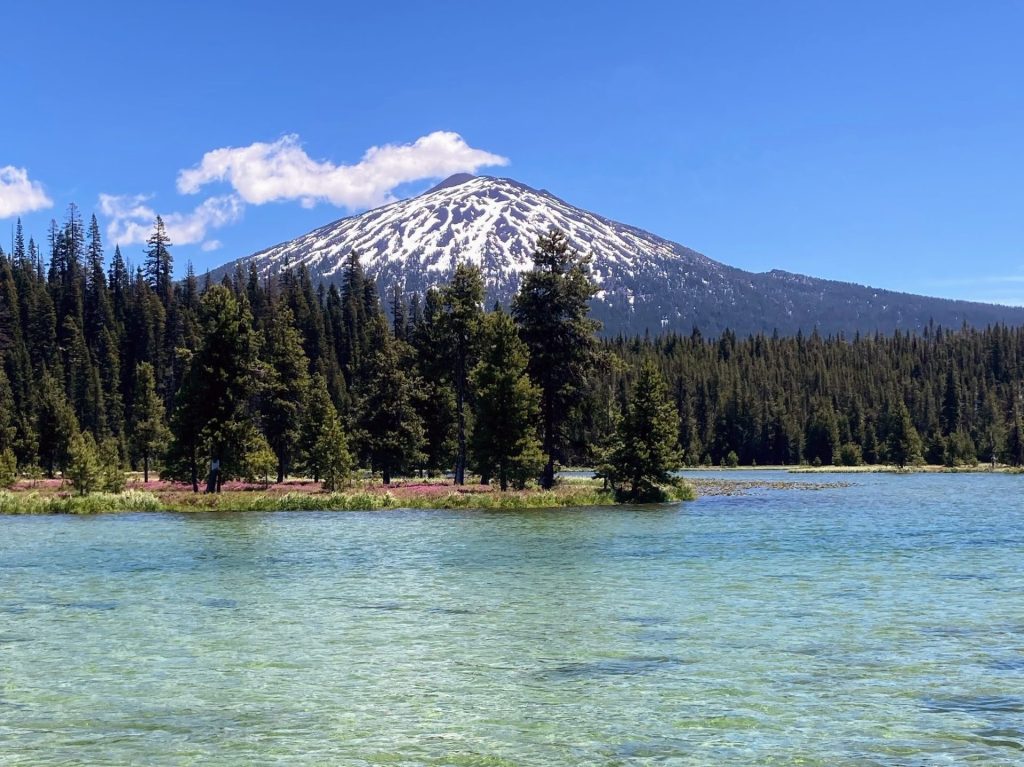
Clear Lake (Linn County) in the Willamette National Forest is a favorite for many Oregonians. Of the many lakes in Oregon given the name of Clear Lake, this one stands out for its truly mesmerizing clear blue turquoise waters. Historically, Clear Lake was formed by a lava event 3000 years ago which blocked the flow of the McKenzie River and inundated the existing forest. Today, this lake has an average depth of 80 ft. and is so clear and devoid of any additional plant life or nutrients that it is deemed “ultraoligotrophic” (Atlas of Oregon Lakes, 1985).

You will see many kayaks, SUPs, rowboats, and canoes on the water. With a visibility level down to 50 ft. deep, standup paddleboarding in particular provides an exciting (and maybe even a little unnerving) viewpoint deep into the underwater forest and the fish swimming around below.

Overall, Clear Lake is an easy paddle but it would not be ideal for first-timers or someone who is likely to fall into the very cold water.

Good to Know:

  • The water is very cold here (35-42F), as it is fed directly from snowmelt. It is not suitable for swimming.
  • Best months to visit are June-October.
  • Arrive early on summer weekends to get parking in the day use lot. Otherwise, be prepared for a longer walk from the overflow parking along the road shoulder.
  • No motorized boats are allowed on the lake.
  • Cellular reception is poor here.

Put-In Locations:

Clear Lake Day Use Area

  • Parking fee: none
  • Launch type: shore
  • Restrooms: flush
  • Open: access to cars opens up when the snow melts, sometime in May
  • The McKenzie Ranger district of the Willamette National Forest division manages the Clear Lake Day Use area. There is shoreline access from the trails leading from the free day use area next to the resort. When the small parking lot fills up, cars will park along the side of the main road leading away from the Day Use area.

Clear Lake Resort

  • Parking fee: none (launch fee, see below)
  • Launch type: dock, boat ramp
  • Restrooms: flush
  • Open: year-round
  • It is managed by Linn County Parks and located on the north end. They charge a launch fee of $5 per watercraft to launch from the docks or boat ramp. You can also rent one of their rowboats or kayaks. The Clear Lake Resort is open year-round (even the rowboat rentals) but 4WD is recommended for access during the snowy winter season.

Coldwater Cove Campground Day Use

  • Parking fee: $8 day use fee or NW Forest Pass or equivalent
  • Launch type: boat ramp
  • Restrooms: vault
  • Check here for the seasonal dates.
  • There is a day use lot and boat ramp located at the far end of Coldwater Cove Campground. The paved parking area can hold about 20 cars. The day use area does not have a lot of space for groups on land.

Driving Directions:

Additional things to do:

Hike the 5-mile trail around the entire lake to really take in the diversity of the landscape and visit the Great Springs pool.

You can drive/hike to the Sahalie Falls and Koosah Falls, the outflow of Clear Lake, which were also formed by the same lava flow.


Check Before you go:

  • Maps and Suggested Routes: Download or print out a map before you go from the SWT Planner App. As a premium member, you can access an ever-growing library of paddling-related maps and suggested routes.
  • Inspect your watercraft. You can help prevent the spread of aquatic invasive species by wiping off any vegetation or debris from your watercraft and making sure it is dry each time before entering a new waterway.
  • PFD, Whistle, and Waterway Access Permit: In Oregon, all paddlecraft 10′ or longer (including SUPs, kayaks, and canoes) require a permit. You can purchase the permit online.

Beware that the routes and information on this site are just general guides and the best path may vary based on water level, obstructions, experience level, equipment, and other conditions. Paddlers are responsible for providing their own safety. Super Water Trails does not assume any liability.

Crane Prairie Reservoir

Skip ahead to check conditions

Crane Prairie Reservoir is located just above Wickiup Reservoir along the Cascade Lakes Scenic Byway and less than an hour’s drive from Bend. The name aptly describes its former existence of flat prairie land that attracted a large population of cranes each year when the Deschutes River flooded the area. This shallow reservoir contributes water for irrigation and when it is full has an average depth of only 11 ft.

There are 23 miles of shoreline including several deep feeder creeks to explore. Views of wildlife are abundant here- osprey, bald eagles, pelicans, and herons, to name a few- as are the views of Mt. Bachelor, South Sister, and Broken Top in the background. This is also a very popular location for fishing.

Beginners can paddle here but should be mindful of the prevailing wind conditions and watch out for the plentiful underwater tree snags.

Good to know:

  • The entire lake is restricted to 10 mph.
  • Open after the lake thaws out and road access is cleared, usually May to October.
  • The water level is kept high in order to protect the Oregon spotted frog habitat.
  • Mosquitoes and other insects can be a problem, esp. June-early August
  • Check for toxic algae blooms as this reservoir has been known to get them.
  • The cellular signal is fair.

Directions:

There are four US Forest Service campgrounds with boat access and an additional boating access point as well as a private resort. The links on this map can provide more details.

Check before you go:

  • Weather: Check the weather forecast for the area and check the wind conditions.
  • Maps and Suggested Routes: Download or print out a map before you go from the SWT Planner App. As a premium member, you can access an ever-growing library of paddling-related maps and suggested routes.
  • Inspect your watercraft. You can help prevent the spread of aquatic invasive species by wiping off any vegetation or debris from your watercraft and making sure it is dry each time before entering a new waterway.
  • PFD, Whistle, and Waterway Access Permit: In Oregon, all paddlecraft 10′ or longer (including SUPs, kayaks, and canoes) require a permit. You can purchase the permit online.

Beware that the routes and information on this site are just general guides and the best path may vary based on water level, obstructions, experience level, equipment, and other conditions. Paddlers are responsible for providing their own safety. Super Water Trails does not assume any liability.

Hosmer Lake

Skip ahead to check conditions

Hosmer Lake at 4997 ft elevation is one of the natural alpine lakes located along the Cascade Lakes National Scenic Byway, just 36 miles west of Bend. The small gravel parking lot serving this incredibly popular paddling and fly-fishing only lake fills up early and there is often a bottleneck at the launch site. Once you get onto the water though, there is more space to spread out, the views are spectacular, and everyone has a good time.

At Hosmer Lake, you can take in the views of Mt. Bachelor, South Sister, and Broken Top above and follow the fish (Atlantic salmon, brook trout, and rainbow trout) swimming in the clear water below you. The journey is just as rewarding as the views as you paddle from one part of the lake, then through a winding channel that opens into a hidden second part of the lake and finally into the shallow creek that flows into the lake.

This is a beginner-friendly paddle as long as it is not too windy. The average depth of this lake is only 3 ft (maximum of 12 ft) but be aware that the lake floor is muddy and peaty.

Good to know:

  • Electric motors are allowed on this lake, restricted to 10 mph.
  • Best times to visit are June to October
  • Mosquitoes can be a problem, esp. July-early August
  • Get there early as parking can fill up
  • Watch out for strong winds, especially in the afternoons
  • The cellular signal is fair.
In order of appearance: Mt. Bachelor, Broken Top, and South Sister

Directions:

From Bend, take Century Drive (FS Road 46) which becomes the Cascade Lakes Scenic Byway. After passing Mt. Bachelor, go to about MP 35 and turn left at sign for Hosmer(4625).

South Campground has a day use area gravel parking lot and boat ramp. There is a US Forest day use fee for this location, but no vending kiosk on site.

Additional things to do:

Check before you go:

  • Weather: Check the weather forecast for the area and check the wind conditions.
  • Maps and Suggested Routes: Download or print out a map before you go from the SWT Planner App. As a premium member, you can access an ever-growing library of paddling-related maps and suggested routes.
  • Maps and Suggested Routes: Download or print out a map before you go from the SWT Planner App. As a premium member, you can access an ever-growing library of paddling-related maps and suggested routes.
  • Inspect your watercraft. You can help prevent the spread of aquatic invasive species by wiping off any vegetation or debris from your watercraft and making sure it is dry each time before entering a new waterway.
  • PFD, Whistle, and Waterway Access Permit: In Oregon, all paddlecraft 10′ or longer (including SUPs, kayaks, and canoes) require a permit. You can purchase the permit online.

Beware that the routes and information on this site are just general guides and the best path may vary based on water level, obstructions, experience level, equipment, and other conditions. Paddlers are responsible for providing their own safety. Super Water Trails does not assume any liability.