Estacada Lake

Skip ahead to check conditions

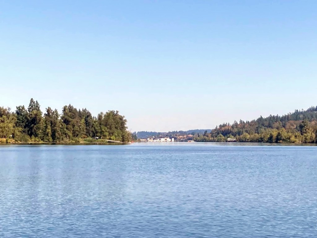
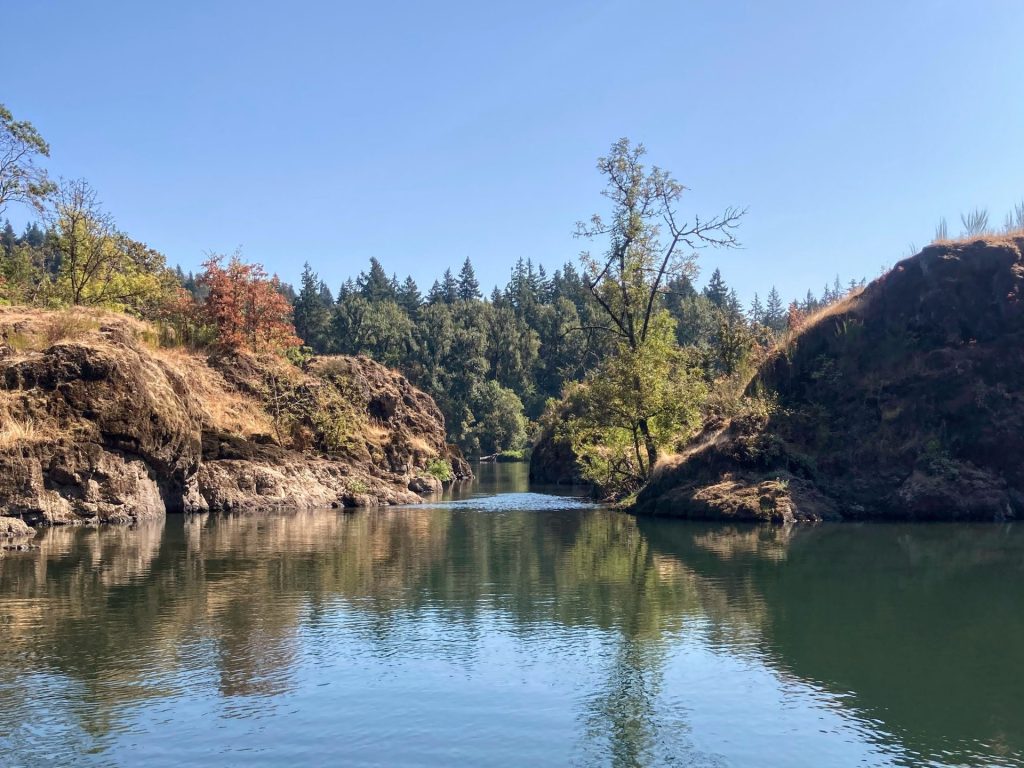
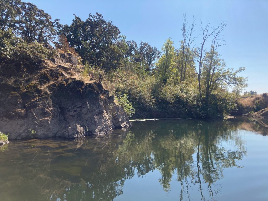
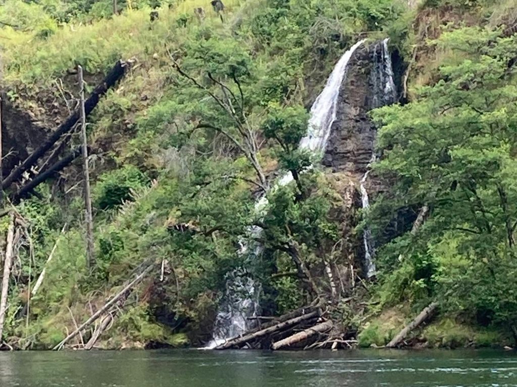
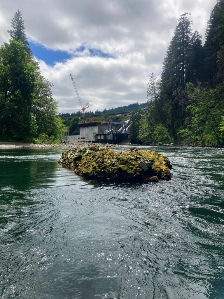
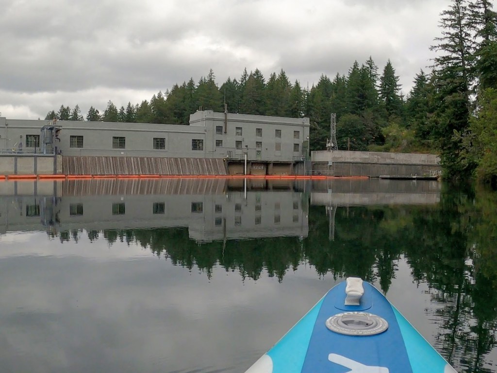
Estacada Lake, located about 40 minutes drive southeast of Portland, is a favorite for many paddlers. It is a “run-of-the-river” reservoir of the Clackamas River managed by PGE for hydroelectric power. The paddle feels very special as you paddle through tall forested canyons, visit gushing waterfalls, and listen for the sound of dripping water. Of note, larger powerboats and PWCs mostly avoid this lake due to the narrow waterway and thus it is very popular for SUPs, kayaks, and smaller boats.

This is considered a beginner-friendly paddle under typical conditions. First-time visitors to Estacada Lake, however, may be surprised by how cold the water is. It reaches only into the 60s during the summer months. You can check on the latest water temperature below.

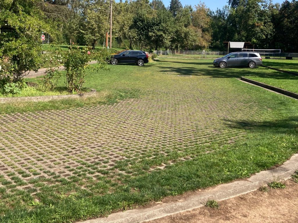
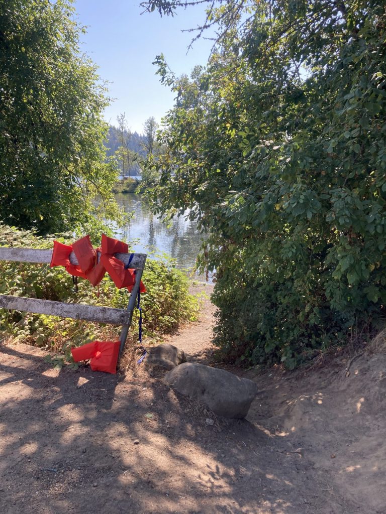
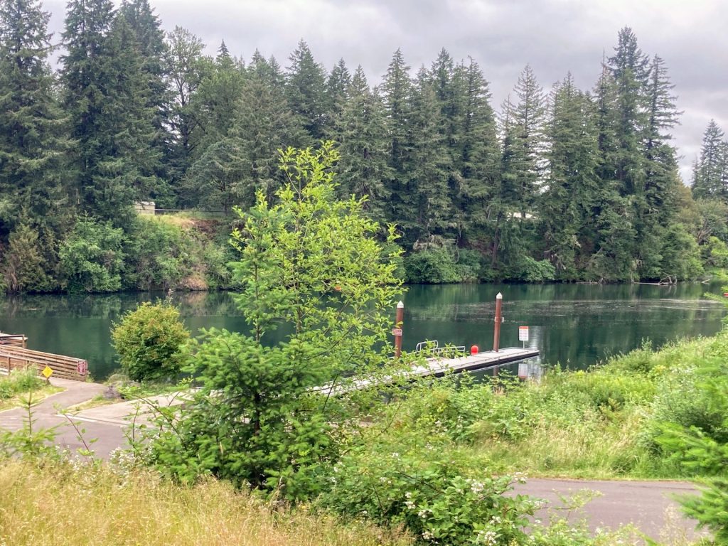
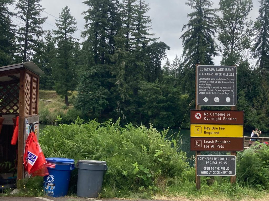
There are 2 main launch sites at Estacada Lake, Milo McIver State Park and Timber Park. Both are located next to the dam but on opposite sides of the lake. The Milo McIver day-use area is open year-round and requires a state parks pass or day-use fee, while the main launch at Timber Park is open seasonally and requires (in 2024) a PGE Parks pass or day-use fee.

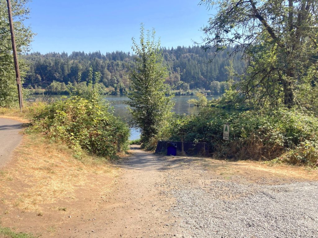
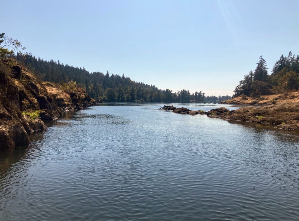
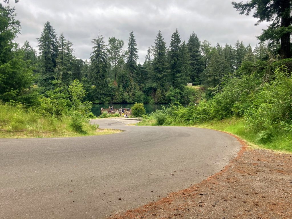
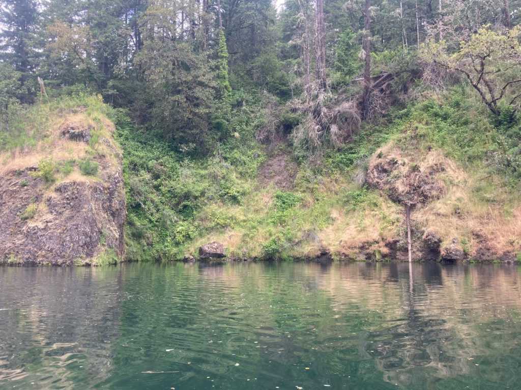
Paddle in the southeast direction away from the River Mill Dam (From Timber Park, go LEFT; from Milo McIver, go RIGHT). It soon narrows to about 300 ft. or less in some sections. Watch or listen for waterfalls and find some coves to play in.

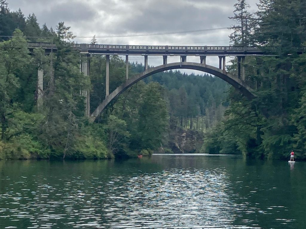
If you paddle beyond the bridge, the crowds thin out and there is a larger waterfall on the left you don’t want to miss. There are also more coves to observe in this section. As you get closer to the turnaround point, the current picks up and you will pass some large rock islands.

Good to Know:

  • Arrive early, as parking may be difficult to find in the summertime, especially on weekends.
  • There are no special waterway speed restrictions for Estacada Lake.
  • The cellular reception is good here.

Launch sites:

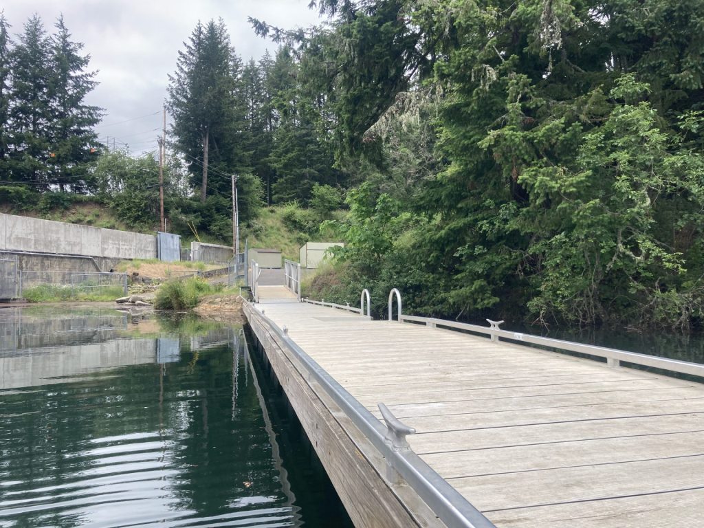
Milo McIver boat ramp

  • Parking fee: day use fee (purchase on site) or Oregon State Parks pass
  • Launch type: ADA kayak dock, boat ramp
  • Restrooms: vault
  • Open: year-round

Driving Directions:

After you enter the park, follow the road to the right, pass the horse arena, then pass a campground, then turn right on S River Lake Road, and go to the end of the road.

Timber Park

  • Parking fee: Beginning in 2024, a $5 parking pass will be required at Timber Park from May 1 to October 15. A season pass will be available for $40. Contact PGE Parks for details.
  • Launch type: boat ramp, dock, primitive bank
  • Restrooms: near the ball field
  • Open: seasonal, 5/1- 10/15
Timber Park dock

Alternative launch sites

At Timber Park, there are a couple of smaller hand launch sites as noted on the map provided by PGE (see map download). There is one behind the ball field and also one on Tulip Road.

Driving Directions:

For Timber Park, drive past the disc golf course and find the parking lot to the left.

Additional things to do:

  • Camp at the Milo McIver State Park campground.
  • Hike on miles of hiking trails at the Milo McIver state park. Also, the nation’s 2nd largest yew tree is located here.
  • Play disc golf? There are disc golf courses at Milo Mc Iver SP and Timber Park, both highly rated in Oregon.

Check before you go:

  • Maps and Suggested Routes: Download or print out a map before you go from the SWT Planner App. As a premium member, you can access an ever-growing library of paddling-related maps and suggested routes.
  • Park Updates: For Milo McIver State Park, check the Oregon State Parks website for more info and for Timber Park call the PGE Parks Information Line at 503-464-8515.
  • Check the water level and flow: closures may occur when it reaches flood stage
  • Inspect your watercraft. You can help prevent the spread of aquatic invasive species by wiping off any vegetation or debris from your watercraft and making sure it is dry each time before entering a new waterway.
  • PFD, Whistle, and Waterway Access Permit: In Oregon, all paddlecraft 10′ or longer (including SUPs, kayaks, and canoes) require a permit. You can purchase the permit online.

Beware that the routes and information on this site are just general guides and the best path may vary based on water level, obstructions, experience level, equipment, and other conditions. Paddlers are responsible for providing their own safety. Super Water Trails does not assume any liability.

Clear Lake (Linn County)

Skip ahead to check conditions

Clear Lake (Linn County) in the Willamette National Forest is a favorite for many Oregonians. Of the many lakes in Oregon given the name of Clear Lake, this one stands out for its truly mesmerizing clear blue turquoise waters. Historically, Clear Lake was formed by a lava event 3000 years ago which blocked the flow of the McKenzie River and inundated the existing forest. Today, this lake has an average depth of 80 ft. and is so clear and devoid of any additional plant life or nutrients that it is deemed “ultraoligotrophic” (Atlas of Oregon Lakes, 1985).

You will see many kayaks, SUPs, rowboats, and canoes on the water. With a visibility level down to 50 ft. deep, standup paddleboarding in particular provides an exciting (and maybe even a little unnerving) viewpoint deep into the underwater forest and the fish swimming around below.

Overall, Clear Lake is an easy paddle but it would not be ideal for first-timers or someone who is likely to fall into the very cold water.

Good to Know:

  • The water is very cold here (35-42F), as it is fed directly from snowmelt. It is not suitable for swimming.
  • Best months to visit are June-October.
  • Arrive early on summer weekends to get parking in the day use lot. Otherwise, be prepared for a longer walk from the overflow parking along the road shoulder.
  • No motorized boats are allowed on the lake.
  • Cellular reception is poor here.

Put-In Locations:

Clear Lake Day Use Area

  • Parking fee: none
  • Launch type: shore
  • Restrooms: flush
  • Open: access to cars opens up when the snow melts, sometime in May
  • The McKenzie Ranger district of the Willamette National Forest division manages the Clear Lake Day Use area. There is shoreline access from the trails leading from the free day use area next to the resort. When the small parking lot fills up, cars will park along the side of the main road leading away from the Day Use area.

Clear Lake Resort

  • Parking fee: none (launch fee, see below)
  • Launch type: dock, boat ramp
  • Restrooms: flush
  • Open: year-round
  • It is managed by Linn County Parks and located on the north end. They charge a launch fee of $5 per watercraft to launch from the docks or boat ramp. You can also rent one of their rowboats or kayaks. The Clear Lake Resort is open year-round (even the rowboat rentals) but 4WD is recommended for access during the snowy winter season.

Coldwater Cove Campground Day Use

  • Parking fee: $8 day use fee or NW Forest Pass or equivalent
  • Launch type: boat ramp
  • Restrooms: vault
  • Check here for the seasonal dates.
  • There is a day use lot and boat ramp located at the far end of Coldwater Cove Campground. The paved parking area can hold about 20 cars. The day use area does not have a lot of space for groups on land.

Driving Directions:

Additional things to do:

Hike the 5-mile trail around the entire lake to really take in the diversity of the landscape and visit the Great Springs pool.

You can drive/hike to the Sahalie Falls and Koosah Falls, the outflow of Clear Lake, which were also formed by the same lava flow.


Check Before you go:

  • Maps and Suggested Routes: Download or print out a map before you go from the SWT Planner App. As a premium member, you can access an ever-growing library of paddling-related maps and suggested routes.
  • Inspect your watercraft. You can help prevent the spread of aquatic invasive species by wiping off any vegetation or debris from your watercraft and making sure it is dry each time before entering a new waterway.
  • PFD, Whistle, and Waterway Access Permit: In Oregon, all paddlecraft 10′ or longer (including SUPs, kayaks, and canoes) require a permit. You can purchase the permit online.

Beware that the routes and information on this site are just general guides and the best path may vary based on water level, obstructions, experience level, equipment, and other conditions. Paddlers are responsible for providing their own safety. Super Water Trails does not assume any liability.

Willamette River Narrows

Skip ahead to check conditions

The Willamette River “Narrows” in West Linn is a popular paddling destination. It is defined by a cluster of basalt islands that are located just a few miles upstream from the dramatic basalt cliffs at the well-known Willamette Falls. In late summer and early fall, when the water level and flow are just right, paddlers can enjoy an easy out-and-back paddle to the Narrows.

Good to Know:

  • Cellular reception is good or excellent here.
  • The best time to visit is late summer or early fall.
  • Watch for stronger current and turbulence at winter and spring flows.
  • Watch out for powerboat traffic on the river and stay to the side.

Launch sites:

Willamette Park (West Linn)

  • Parking fee: free
  • Launch type: beach
  • Restrooms: flush toilets near playground
  • Open: year-round

There is a grassy parking lot located behind Willamette Park in West Linn at 12th St. and Volpp St. It is about 100 ft carry distance from the parking lot to the beach launch. The access to the beach is via a sloped narrow dirt path, suitable for hand-carrying your gear.

There is also parking along the west end of Volpp St. which leads to a wider, more gradual path about 160 ft to the beach.

Driving Directions:

Bernert Landing

  • Parking fee: none
  • Launch type: boat ramp, dock
  • Restrooms: flush toilets
  • Open: year-round

This launch site is located directly on the Willamette River. Parking is primarily for trailers here.

Driving Directions:

Additional things to do:

  • To paddle up to the Willamette Falls, the 2nd largest waterfall in the Pacific Northwest, you would need to launch from a different point further downstream. There are several launches to choose from that are just a 5-mile drive away. See the post on Willamette Falls for more details.

Check before you go:

  • Maps and Suggested Routes: Download or print out a map before you go from the SWT Planner App. As a premium member, you can access an ever-growing library of paddling-related maps and suggested routes.
  • Weather: check that it is not too windy

[ventus width=”100%” height=”300px” radius=”10px” lat=”45.339″ lon=”-122.650″ zoom=”9″ layer=”wind” scale=”F” units=”mph” marker=”true” forecast=”true” time=”now].

  • Water Temperature: Read the cold water safety page if you need more background info.
 USGS Water-data graph for site 14197900
  • Check the water level: When it rises above 56 ft. the flow is usually more turbulent, especially in the rocky areas. At lower water levels, some places may not be passable.
 USGS Water-data graph for site 14207740
  • Toxic algae blooms: This temporary condition occurs at some of the area lakes in the summer and may affect your health if water or fish is consumed during these conditions. Get more info on how to tell if algae is harmful and watch for water advisories but also use common sense if you see water that doesn’t look right.
  • Inspect your watercraft. You can help prevent the spread of aquatic invasive species by wiping off any vegetation or debris from your watercraft and making sure it is dry each time before entering a new waterway.
  • PFD, Whistle, and Waterway Access Permit: In Oregon, all paddlecraft 10′ or longer (including SUPs, kayaks, and canoes) require a permit. You can purchase the permit online.

Beware that the routes and information on this site are just general guides and the best path may vary based on water level, obstructions, experience level, equipment, and other conditions. Paddlers are responsible for providing their own safety. Super Water Trails does not assume any liability.