
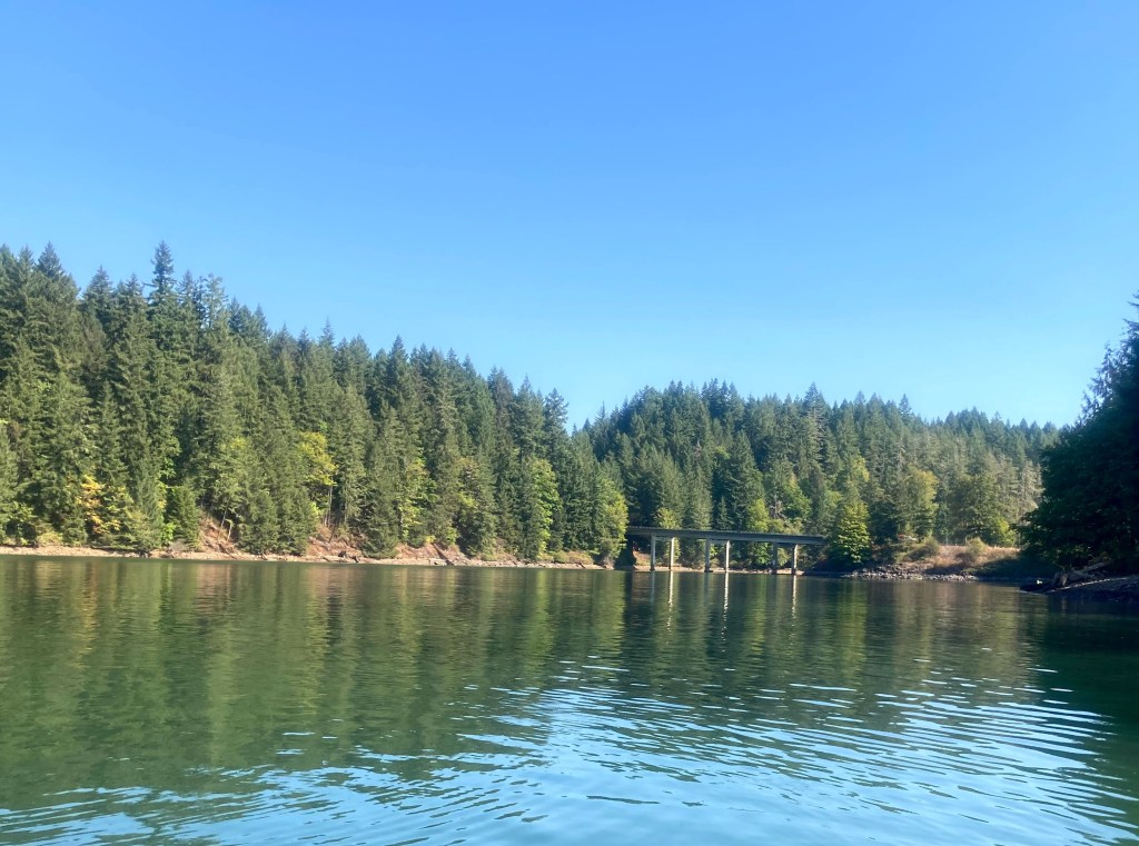
Foster Reservoir is located in the foothills of the Cascade Range just east of Sweet Home. Like other reservoirs in the area, it is very popular for boating and jet skiing in the summertime. But if you don’t enjoy surfing wakes, you can go up either of two no-wake zone arms for a gorgeous scenic paddle with waterfalls.
Foster regulates flow from Green Peter Reservoir and also impounds water from the South Santiam River for flood control downstream and hydroelectric power. You can read more info about the reservoirs and dams in the area here.
This post describes the water route from Calkins Day Use area and up the southern arm, which is where the S. Santiam River flows in. The paddle up the northern arm will be posted separately.
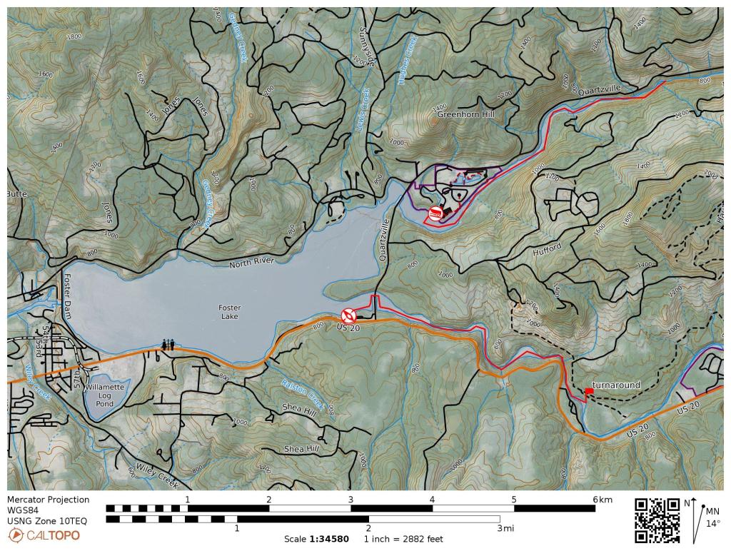
- Route length– up to 5.2 miles out and back (~2.5 hr paddling time)
- Parking – Calkins day use area, 44529 Quartzville Road, Foster, OR
- Fee – none.
- Restrooms– vault toilets
- Cellular signal– poor
- Best times to go – open midMay to September
- Rentals: at Lewis Creek Park during summer
Note that it is about 100 yards from the near end of the parking lot to the boat launch, if you are planning to carry your gear from the parking lot. The launch site has a busy drive-up concrete boat ramp and a dock.
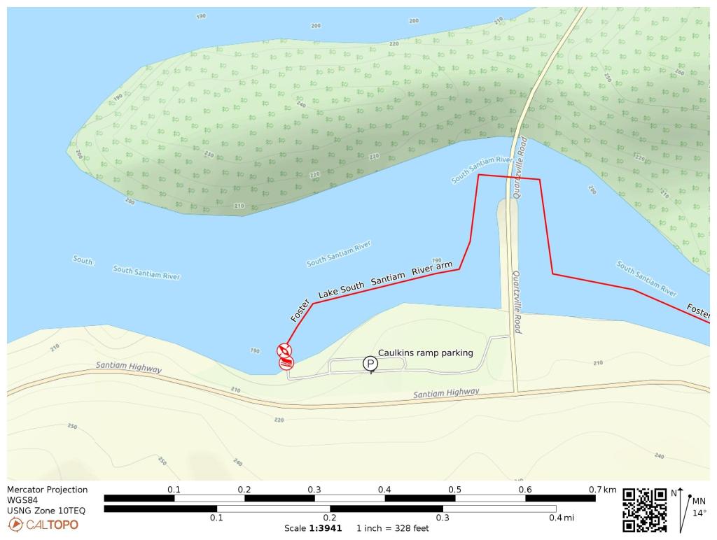
Paddle route: Head right and pass under the bridge. The rest of the route should be a no-wake (< 5mph) zone.
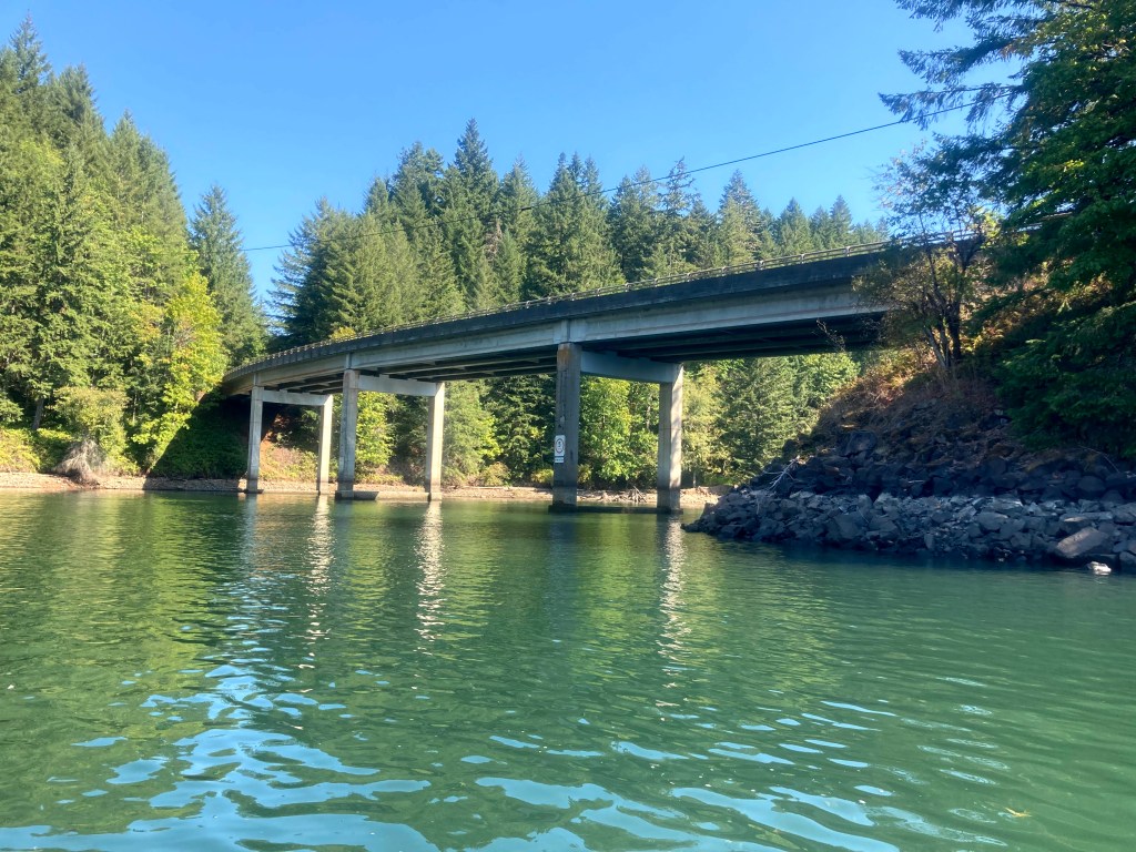
Pass under bridge
Keep an eye out for the two small cascading waterfalls on the right.
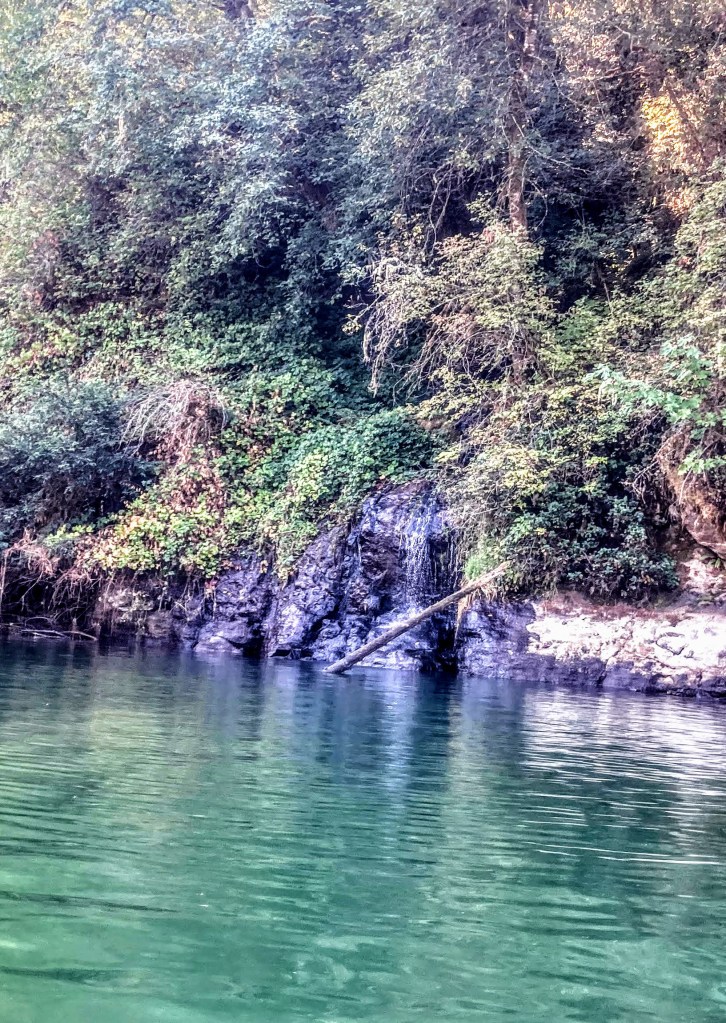
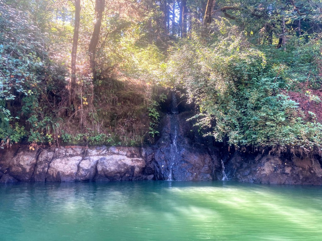
You could shorten your route to about 3.2 miles if you want to turn around after the 2nd waterfall.
As a reregulating dam for Green Peter Reservoir, the water level at Foster is kept at a steady level during the summer and is not drawn down for winter until late September.
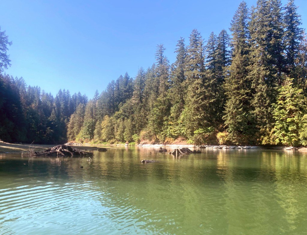
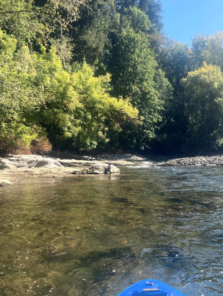
you may continue for about another mile before you get to some riffles and shallow water. Turnaround and enjoy a little assist on the way back.
Check before you go:
- Park status: Calkins day use area is managed by Linn County Parks.
- Water temps: Here is a graph of the water temperature trend during an entire year, just to give you an idea of what to expect in case you take a splash.

Note that the water can reach about 70F in September even though the water monitor shows much cooler waters.
- Toxic algae blooms: This temporary condition occurs at some of the area lakes in the summer and may affect your health if water or fish is consumed during these conditions. Get more info on how to tell if algae is harmful and watch for water advisories but also use common sense if you see water that doesn’t look right.
